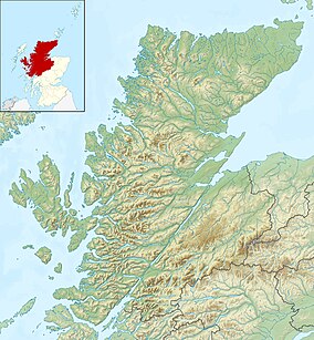
Glen Strathfarrar (Scottish Gaelic: Srath Farair) is a glen in the Highland region of Scotland, near Loch Ness.
The Glen is part of the Affric-Beauly hydro-electric power scheme, with a dam at Loch Monar and a 9 km tunnel carrying water to an underground power station at Deanie; a second dam just below Loch Beannacharan feeds a tunnel carrying water to Culligran power station (also underground).[2] The Monar dam at Loch Monar is the largest arch dam in Britain.[3]
The central section of Glen Strathfarrar (covering 4,027 ha (9,950 acres)[1]) is designated as a national scenic area,[4] one of forty such areas in Scotland, which have been defined so as to identify areas of exceptional scenery and to ensure its protection from inappropriate development.[5] The area covered by the NSA represents the section of the glen least affected by the hydro-electric scheme, and includes the Culligran Falls.[6]
^ ab"National Scenic Areas - Maps". SNH. 20 December 2010. Archived from the original on 12 June 2018. Retrieved 24 January 2018.
^"Power From the Glens" (PDF). Scottish and Southern Energy. p. 12. Archived from the original (PDF) on 18 October 2007. Retrieved 8 March 2008.
^Cite error: The named reference smg was invoked but never defined (see the help page).
^"Glen Strathfarrar National Scenic Area". NatureScot. Retrieved 2 October 2020.
^"National Scenic Areas". NatureScot. Retrieved 2 October 2020.
^"The special qualities of the National Scenic Areas" (PDF). Scottish Natural Heritage. 2010. Retrieved 6 March 2018.
GlenStrathfarrar (Scottish Gaelic: Srath Farair) is a glen in the Highland region of Scotland, near Loch Ness. The Glen is part of the Affric-Beauly hydro-electric...
Glen Affric (Scottish Gaelic: Gleann Afraig) is a glen south-west of the village of Cannich in the Highland region of Scotland, some 15 miles (25 kilometres)...
Glen Coe (Scottish Gaelic: Gleann Comhann pronounced [klan̪ˠˈkʰo.ən̪ˠ]) is a glen of volcanic origins, in the Highlands of Scotland. It lies in the north...
t-Srùigh or Scottish Gaelic: Sruidh) is a small village at the end of GlenStrathfarrar, about 15 km south-west of Beauly in the Highland council area of...
part of the national park, alongside other hill ranges such as the Angus Glens and the Monadhliath, and lower areas like Strathspey. The Cairngorms consists...
Loch Monar is a freshwater loch situated at the head of GlenStrathfarrar, in the West Highlands of Scotland. Since the 1960s, it has been dammed as part...
Scottish Gaelic: Na Tròiseachan) generally refers to an area of wooded glens, braes, and lochs lying to the east of Ben Lomond in the Stirling council...
fought under a Fraser of Struy (from a small village at the mouth of GlenStrathfarrar). The battle left eighty-seven Fraser widows. A poem about the battle...
& the Trossachs, the Cairngorms, Glen Coe-Ben Nevis-Black Mount, Wester Ross and GlenStrathfarrar-Glen Affric-Glen Cannich. The government designated...
formation of raised beaches. Birchwoods grow on the steep slopes of the glens and above the shoreline, and there are some areas of Caledonian pinewoods...
See Glen Shiel for the much smaller Loch Shiel in Lochalsh. Loch Shiel (Scottish Gaelic: Loch Seile) is a freshwater loch situated 20 kilometres (12 mi)...
NH376058 near Fort Augustus Culligran Falls River Farrar NH378401 GlenStrathfarrar Culnaskiach Falls on tributary of Bruiach Burn NH487361 near Beauly...
hillwalkers at all times of the year, with the most common ascent route being from Glen Muick. Care should be taken on the summit in poor visibility: the plateau...
 Global Information