Sinhalese – 75%, Sri Lanka Tamils – 16%, Sri Lankan Moors – 9%
Map of Asia showing the location of Sri Lanka
Sri Lanka, formerly called Ceylon, is an island nation in the Indian Ocean, southeast of the Indian subcontinent, in a strategic location near major sea lanes.[1] The nation has a total area of 65,610 square kilometres (25,330 sq mi), with 64,630 square kilometres (24,950 sq mi) of land and 980 square kilometres (380 sq mi) of water.[1] Its coastline is 1,340 kilometres (830 mi) long.[1] The main island of Sri Lanka has an area of 64, 058 km2; it is the twenty-fifth largest island in the world by area.[2] Dozens of offshore islands account for the remaining 1552 km2 area.[3] The largest offshore island, Jaffna Island is separated by Chundikulam lagoon and Mannar Island, is linked to Adam's Bridge, a land connection to the Indian mainland, which is now mostly submerged with only a chain of limestone shoals remaining above sea level. According to temple records, this natural causeway was formerly whole, but was breached by a violent storm (probably a cyclone) in 1480.[4] The formation is also known as Rama's Bridge, as according to Hindu mythology, it was constructed during the rule of Lord Rama.[5]
Sri Lanka's climate includes tropical monsoons; the northeast monsoon (December to March), and the southwest monsoon (June to October).[1] Its terrain is mostly low, flat to rolling plain, with the mountainous upcountry in the south-central interior.[1] The highest point is Pidurutalagala at 2,524 m (8,281 ft).[1] Natural resources include limestone, graphite, mineral sands, gems, phosphates, and clay.
^ abcdef"Sri Lanka". The World Factbook. Central Intelligence Agency. May 11, 2021. Retrieved May 14, 2021. This article incorporates text from this source, which is in the public domain.{{cite web}}: CS1 maint: postscript (link)
^"Joshua Calder's World Island Info – Largest Islands of the World". Worldislandinfo.com. Retrieved 2016-01-30.[unreliable source?]{{cite web}}: CS1 maint: postscript (link)
^Manimaran, G. (2008-08-01). "Geoenvironmental Scenario on the Landward Migration of Thamiraparani Microlithic Culture to Sri Lanka Through Adam's Bridge". Journal of the Geological Society of India. 72: 222–224..
^"Adam's bridge". Encyclopædia Britannica. 2007. Archived from the original on 13 January 2008. Retrieved 14 September 2007.
and 28 Related for: Geography of Sri Lanka information
SriLanka, formerly called Ceylon, is an island nation in the Indian Ocean, southeast of the Indian subcontinent, in a strategic location near major sea...
represent the country and its people within SriLanka and abroad as well as traditions, culture, history and geography. Several other symbols do not have official...
The SriLankan Civil War (Sinhala: ශ්රී ලංකාවේ සිවිල් යුද්ධය, romanized: śrī laṁkāvē sivil yuddhaya; Tamil: இலங்கை உள்நாட்டுப் போர், romanized: Ilaṅkai...
as an overview of and topical guide to SriLanka: SriLanka – island country in the northern Indian Ocean off the southeast coast of the Indian subcontinent...
The mixed economy ofSriLanka was worth $84 billion by nominal gross domestic product (GDP) in 2019 and $296.959 billion by purchasing power parity (PPP)...
National Emblem ofSriLanka is used by the State ofSriLanka and the SriLankan government in connection with the administration and government of the country...
and geography. The Supreme Court ofSriLanka is the highest court for all criminal and civil cases in SriLanka. This is followed by the Court of Appeal...
is the naval arm of the SriLanka Armed Forces and is classed as the country's most vital defence force due to its island geography and is responsible...
legislative capital ofSriLanka is Sri Jayawardenepura Kotte and the executive and judicial capital is Colombo. Over the course of the island's history...
romanized: Mākāṇam) are the first level administrative divisions of Sri Lanka. Currently, SriLanka is divided into 9 provinces. Each province is further divided...
The SriLankan Ordinary Level (O-level) is a General Certificate of Education (GCE) qualification in SriLanka, conducted by the Department of Examinations...
This is a demography of the population ofSriLanka including population density, ethnicity, education level, health of the population, economic status...
divisions ofSriLanka, preceded by provinces. SriLanka has 25 districts organized into 9 provinces. Districts are further divided into a number of divisional...
list of airports in SriLanka. Airport names shown in bold indicate the facility has scheduled passenger service on a commercial airline. List ofSri Lankan...
president ofSriLanka (Sinhala: ශ්රී ලංකා ජනාධිපති Śrī Laṃkā Janādhipathi; Tamil: இலங்கை சனாதிபதி Ilankai janātipati) is the head of state and head of government...
SriLankan Tamils (Tamil: இலங்கை தமிழர், ilankai tamiḻar or ஈழத் தமிழர், īḻat tamiḻar), also known as Ceylon Tamils or Eelam Tamils, are Tamils native...
media related to Rivers ofSriLanka. List of dams and reservoirs in SriLanka List of waterfalls in SriLanka Grade 11 Geography textbook. "Horton Plains...
SriLanka's electricity demand is currently met by nine thermal power stations, fifteen large hydroelectric power stations, and fifteen wind farms, with...
The Government ofSriLanka (GoSL) (Sinhala: ශ්රී ලංකා රජය, romanized: ŚrīLankā Rajaya; Tamil: இலங்கை அரசாங்கம்) is a Semi-presidential republic determined...
to SriLanka because of its close geographical and commercial ties. Records suggest that St. Thomas Christians and Nestorian Christians lived in Sri Lanka...
buildings and structures in SriLanka in terms of the highest architectural detail. Apart from the historical timeline of tallest structures, structures...
The culture ofSriLanka mixes modern elements with traditional aspects and is known for its regional diversity. SriLankan culture has long been influenced...
and largest city ofSriLanka by population. According to the Brookings Institution, the Colombo metropolitan area has a population of 5.6 million, and...
 Global Information
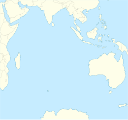


 This article incorporates text from this source, which is in the public domain.