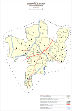
Garhani (Hindi: गड़हनी) is a town and corresponding community development block in Bhojpur district of Bihar, India. As of 2011, its population was 5,597, in 959 households. The total block population was 103,262, in 16,427 households.[2]
^ ab"Geonames.org. Garhāni". Retrieved 20 August 2020.
^ abcd"Census of India 2011: Bihar District Census Handbook - Bhojpur, Part A (Village and Town Directory)". Census 2011 India. pp. 27–94, 604–627. Retrieved 20 August 2020.
Garhani (Hindi: गड़हनी) is a town and corresponding community development block in Bhojpur district of Bihar, India. As of 2011, its population was 5...
Sandesh. Agiaon Assembly constituency comprises: Charpokhari CD block Garhani CD block Agiaon CD block As per the estimates of 2011 census, out of total...
is as follows: Arrah Agiaon Barhara Koilwar Udwant Nagar Sandesh Sahar Garhani Arrah is the headquarters of the Bhojpur district. On 1 June 1865, the...
Morasiya, also spelled Morasia, is a village and in Garhani block of Bhojpur district, in Bihar, India. As of 2011, its population was 1,796, in 255 households...
College Buxar T.S.I.M College, Ara, Bhojpur Jan Sahkari College (Barap), Garhani Bhojpur Constituent colleges of Veer Kunwar Singh University Harprasad...
India: Dubauli, Bihiya, a village in Bhojpur district, Bihar Dubauli, Garhani, a village in Bhojpur district, Bihar Dighwa Dubauli, a village in Gopalganj...
the Arwal block to the east, the Charpokhari block to the west and the Garhani block towards north. Cities near Ekwari include Agion, arwal, Piro, Arrah...
cattle fair as well which has been discontinued since a decade. Behea, Garhani, Charpokhari and Piro are the nearby railway stations to Kakila. Ara Junction...
 Global Information