 Global Information
Frauenau Dam information
| Frauenau Dam | |
|---|---|
 | |
| Official name | Trinkwassertalsperre Frauenau |
| Coordinates | 49°00′49″N 13°20′00″E / 49.0137°N 13.3334°E |
| Construction began | 1976–1983 |
| Dam and spillways | |
| Impounds | Little Regen, Hirschbach |
| Height (foundation) | 84.7 or 86 m |
| Height (thalweg) | 70.5 m |
| Length | 640 m |
| Elevation at crest | 770.8 m[1] |
| Width (crest) | 9 m |
| Dam volume | 2.5 Mm³ |
| Reservoir | |
| Total capacity | 21.7 Mm³ |
| Active capacity | 20.8 Mm³ |
| Catchment area | 30.4 km² |
| Surface area | 94 ha |
| Normal elevation | 767 m |
| Power Station | |
| Installed capacity | 617 kW |
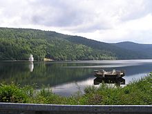
The Frauenau Dam (German: Trinkwassertalsperre Frauenau or Trinkwasserspeicher Frauenau) in the Bavarian Forest, in Germany, was built in 1983 to ensure the drinking water supply to large parts of Lower Bavaria.
- ^ Hochwassermarken des hnd