This article is about the stream in Virginia. For the sub-neighborhood in Pittsburgh, see Four Mile Run (Pittsburgh).
Four Mile Run
Four Mile Run near Arlington's Jennie Dean Park
Location of mouth
Location
Country
United States
Physical characteristics
Source
• location
Fairfax County, Virginia (paved over)
• elevation
339 feet (103 m)
Mouth
• location
Potomac River in Arlington County, Virginia
Length
9.35 miles (15 km)
Basin size
19.7 square miles (51 km2), 17 square miles (44 km2) in the non-tidal area
Basin features
GNIS feature ID
1478084[1]
Four Mile Run is a 9.4-mile-long (15.1 km)[2] stream in Northern Virginia that starts near Interstate 66, at Gordon Avenue in Fairfax County and proceeds southeast through Falls Church to Arlington County in the U.S. state of Virginia. Most of the stretch is parkland and is paralleled by two paved non-motorized transport and recreational trails, the Washington & Old Dominion Railroad Trail and the Four Mile Run Trail.
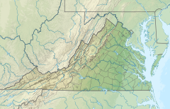
In Arlington, the stream passes from the Piedmont through the Fall Line to the Atlantic Coastal Plain in a deep forested valley. The stream's eastern section forms the boundary of Arlington County and the City of Alexandria. The stream eventually empties into the Potomac River immediately south of Reagan National Airport.[3]
The name Four Mile Run does not derive from its length. A 2001 documentary film alleged that the name resulted from a misreading of an old map. The documentary stated that an old flour mill near the Potomac gave the stream the name of "Flour Mill Run", but the map had faded letters.[4] A more plausible explanation is that the mouth of Four Mile Run is approximately four miles upriver from the mouth of Hunting Creek (sometimes called Great Hunting Creek) which is formed by the confluence of Cameron Run and Hooff's Run where they join the Potomac on the southern boundary of the City of Alexandria.[5] Four Mile Run runs into the tidal Four Mile Creek within 1 mile (2 km) of the mouth of the stream.
^"Four Mile Run". Geographic Names Information System. United States Geological Survey, United States Department of the Interior.
^U.S. Geological Survey. National Hydrography Dataset high-resolution flowline data. The National Map Archived 2012-03-29 at the Wayback Machine, accessed August 15, 2011
^Coordinates of Four Mile Creek at confluence with Potomac River: 38°50′26″N77°02′44″W / 38.840443°N 77.045531°W / 38.840443; -77.045531 (Four Mile Creek at confluence with Potomac River)
^Eckert, Dave (2001). "Reviving an Urban Stream: Four Mile Run Documentary". Film narrated by Frank Stasio. Fairfax, Virginia: Northern Virginia Regional Commission. Retrieved 2013-02-26.
^Stetson, Charles (1932), "Washington's Woods on Four Mile Run", Records of the Columbia Historical Society, vol. 35/36, Washington, D.C.: Historical Society of Washington, D.C., pp. 154–182, JSTOR 40067515
FourMileRun is a 9.4-mile-long (15.1 km) stream in Northern Virginia that starts near Interstate 66, at Gordon Avenue in Fairfax County and proceeds...
The world record in the milerun is the fastest time set by a runner in the middle-distance track and field event. World Athletics is the official body...
The FourMileRun Trail is a 7-mile long, paved shared use path in Arlington County and Falls Church. It runs along FourMileRun from Benjamin Banneker...
The milerun (1,760 yards or exactly 1,609.344 metres) is a middle-distance foot race. The history of the milerun event began in England, where it was...
The 2 mile (10,560 feet or 3,218.688 metres) is a historic running distance. Like the milerun, it is still contested at some invitational meets due its...
This is a complete list of current bridges and other crossings of FourMileRun from its mouth at the Potomac River to its source. All locations arefalls...
Maryland, then to Langley High School in McLean, Virginia for 1977; and FourMileRun Park in Alexandria, Virginia. From 1995 to 2004, the game was played...
event is usually run by completing four laps of an indoor 200-metre track. The event was derived from the imperial measurement of a half mile (880 yards),...
The Four Minute Mile is a television mini series about the race to run the four-minute mile, focusing on the rivalry between Roger Bannister and John...
Test, one that includes a minimum of 70 push-ups in 2 minutes, a timed four-milerun in 31 minutes, and a timed 1,000-meter swim with fins in 20 minutes...
(disambiguation) FourMileRun in Virginia FourMile Waterhole, Northern Territory, Australia FourMile Creek State Park in New York State FourMile Historic...
5000 metres or 5000-metre run is a common long-distance running event in track and field, approximately equivalent to 3 miles 188 yards or 16,404 feet...
near FourMileRun. The western trailhead is 75 yards (69 m) east of North Patrick Henry Drive's overpass of I-66, the W&OD Trail and FourMileRun. The...
Fineview Friendship Garfield The Valley Hilltop Glen Hazel Greenfield FourMileRun Hays Hazelwood Highland Park Homewood North Homewood South Homewood...
verifiable home run in professional baseball history. The home run was measured at a distance of 582 feet (177 m) and was hit inside Denver's Mile High Stadium...
exercise and four Commando tests will follow: The endurance course: Two miles of tunnels, pools, streams, bogs and woods, followed by a fourmilerun back to...
which it sends to the Monongahela River via the FourMileRun. Two streams, Phipps Run and Panther Hollow Run, flow through Schenley Park, feeding the lake...
approximately 2+1⁄2 miles (4.0 km). It begins where FourMileRun empties into the Monongahela River and runs through the neighborhood of FourMileRun north into...
 Global Information