 Global Information
East Fork Millicoma River information
| East Fork Millicoma River | |
|---|---|
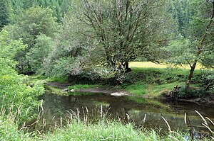 Downstream of Nesika County Park | |
 Location of the mouth of the East Fork Millicoma River in Oregon | |
| Etymology | Possibly the Coos people's name for the river[2] |
| Location | |
| Country | United States |
| State | Oregon |
| County | Coos |
| Physical characteristics | |
| Source | eastern Coos County |
| • location | near Douglas County line, Southern Oregon Coast Range |
| • coordinates | 43°24′50″N 123°46′04″W / 43.41389°N 123.76778°W[1] |
| • elevation | 1,921 ft (586 m)[3] |
| Mouth | Millicoma River |
• location | Allegany |
• coordinates | 43°25′27″N 124°01′49″W / 43.42417°N 124.03028°W[1] |
• elevation | 20 ft (6.1 m)[1] |
| Length | 24 mi (39 km)[4] |
| Discharge | |
| • minimum | 1 cu ft/s (0.028 m3/s) |
The East Fork Millicoma River is a tributary, about 24 miles (39 km) long, of the Millicoma River in the U.S. state of Oregon. Rising in eastern Coos County, it flows generally west to the community of Allegany, where it joins the West Fork Millicoma River to form the Millicoma. In turn, the Millicoma, which is only about 9 miles (14 km) long, joins the South Fork Coos River to form the Coos River. The Coos River, itself only about 5 miles (8 km) long, empties into the eastern end of Coos Bay, which connects to the Pacific Ocean.[4]
Forming north of Coos Ridge in the Southern Oregon Coast Range near Ivers Peak, the river flows west, receiving Beulah Creek from the right about 18 miles (29 km) from the mouth. About 6 miles (9.7 km) further downstream, Little Matson Creek enters from the right, and a mile or so later Fox Creek enters from the left. The river receives Glenn Creek from the right about 7 miles (11 km) from the mouth.[4][5] Glenn Creek and one of its tributaries, Silver Creek, cascade over Golden and Silver falls in the Golden and Silver Falls State Natural Area.[6][7] The East Fork Millicoma River then passes a stream gauge managed by the Coos Watershed Association.[8]
Rodine Creek enters from the left about 2 miles (3 km) later. Just below the confluence with Rodine Creek, Nesika County Park is on the left, and Hodges Creek enters from the left. Less than a mile from Allegany, Marlow Creek enters from the right and then Nowlit Creek, also from the right, before the East Fork meets the West Fork to form the Millicoma. East Fork Millicoma Road runs parallel to the river for much of its course.[4][5]
The river supports coastal cutthroat trout and a run of winter steelhead. Nesika County Park, about 2.5 miles (4.0 km) east of Allegany on East Fork Millicoma Road, offers bank access for steelhead fishing.[9]
- ^ a b c "East Fork Millicoma River". Geographic Names Information System. United States Geological Survey. November 28, 1980. Retrieved April 2, 2011.
- ^ McArthur, pp. 646–47
- ^ Source elevation derived from Google Earth search using GNIS source coordinates.
- ^ a b c d United States Geological Survey. "United States Geological Survey Topographic Map". TopoQuest. Retrieved April 2, 2011. The maps include river mile (RM) markers for the first 19 miles (31 km). The markers start with 0 at the mouth of the Millicoma River and continue up the East Fork, which begins between markers 8 and 9, to marker 28. The additional 5 miles (8.0 km) is an estimate based on map scale and ruler. Relevant map quadrangles from mouth to source are Allegany, Golden Falls, and Ivers Peak.
- ^ a b Oregon Atlas and Gazetteer (Map) (1991 ed.). DeLorme Mapping. § 33–34. ISBN 978-0-89933-347-2.
- ^ "Golden And Silver Falls State Natural Area". Oregon Parks and Recreation Department. Retrieved April 6, 2011.
- ^ Richard, Terry (July 22, 2007). "OK now? Which is it, Golden or Silver?". The Oregonian. Retrieved April 6, 2011.
- ^ "East Fork Millicoma River Gaging Station". Coos Watershed Association. Archived from the original on March 22, 2012. Retrieved April 3, 2011.
- ^ Sheehan, p. 80