 Global Information
Douglas Navigation information
53°35′01″N 2°44′45″W / 53.5837°N 2.7458°W
| Douglas Navigation | |
|---|---|
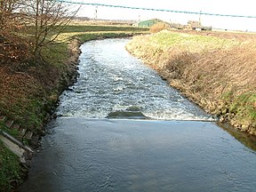 The river from Wanes Blades bridge, between Parbold and Rufford | |
| Specifications | |
| Locks | 13 |
| Status | Reverted to river |
| History | |
| Original owner | Douglas Navigation Company |
| Date of act | 1720 |
| Date completed | 1742 |
| Date closed | 1801 |
| Geography | |
| Start point | Wigan |
| End point | River Ribble |
| Branch(es) | Rufford Branch |
| Branch of | Leeds and Liverpool Canal |
Douglas Navigation | |||||||||||||||||||||||||||||||||||||||||||||||||||||||||||||||||||||||||||||||||||||||||||||||||||||||||||||||||||||||||||||||||||||||||||||||||||||||||||||||||||||||||||||||||||||||||||||||||||||||||||||||||||||||||||||||||||||||||||||||||||||||||||||||||||||||||||||||||||||||||||||||||||||||||||||||||||||||||||||||||||||||||||||||||||||||||||||||||||||||||||||||||||||||||||||||||||||||||||||||
|---|---|---|---|---|---|---|---|---|---|---|---|---|---|---|---|---|---|---|---|---|---|---|---|---|---|---|---|---|---|---|---|---|---|---|---|---|---|---|---|---|---|---|---|---|---|---|---|---|---|---|---|---|---|---|---|---|---|---|---|---|---|---|---|---|---|---|---|---|---|---|---|---|---|---|---|---|---|---|---|---|---|---|---|---|---|---|---|---|---|---|---|---|---|---|---|---|---|---|---|---|---|---|---|---|---|---|---|---|---|---|---|---|---|---|---|---|---|---|---|---|---|---|---|---|---|---|---|---|---|---|---|---|---|---|---|---|---|---|---|---|---|---|---|---|---|---|---|---|---|---|---|---|---|---|---|---|---|---|---|---|---|---|---|---|---|---|---|---|---|---|---|---|---|---|---|---|---|---|---|---|---|---|---|---|---|---|---|---|---|---|---|---|---|---|---|---|---|---|---|---|---|---|---|---|---|---|---|---|---|---|---|---|---|---|---|---|---|---|---|---|---|---|---|---|---|---|---|---|---|---|---|---|---|---|---|---|---|---|---|---|---|---|---|---|---|---|---|---|---|---|---|---|---|---|---|---|---|---|---|---|---|---|---|---|---|---|---|---|---|---|---|---|---|---|---|---|---|---|---|---|---|---|---|---|---|---|---|---|---|---|---|---|---|---|---|---|---|---|---|---|---|---|---|---|---|---|---|---|---|---|---|---|---|---|---|---|---|---|---|---|---|---|---|---|---|---|---|---|---|---|---|---|---|---|---|---|---|---|---|---|---|---|---|---|---|---|---|---|---|---|---|---|---|---|---|---|---|---|---|---|---|---|---|---|---|---|---|---|---|---|---|---|---|---|---|---|---|---|---|---|---|---|---|---|---|---|---|---|---|---|---|---|---|---|---|---|---|---|---|
| |||||||||||||||||||||||||||||||||||||||||||||||||||||||||||||||||||||||||||||||||||||||||||||||||||||||||||||||||||||||||||||||||||||||||||||||||||||||||||||||||||||||||||||||||||||||||||||||||||||||||||||||||||||||||||||||||||||||||||||||||||||||||||||||||||||||||||||||||||||||||||||||||||||||||||||||||||||||||||||||||||||||||||||||||||||||||||||||||||||||||||||||||||||||||||||||||||||||||||||||
The Douglas Navigation was a canalised section of the River Douglas or Asland, in Lancashire, England, running from its confluence with the River Ribble to Wigan. It was authorised in 1720, and some work was carried out, but the undertakers lost most of the share money speculating on the South Sea Bubble. Alexander Leigh attempted to revive it eleven years later, and opened it progressively between 1738 and 1742. Leigh began work on a parallel canal called Leigh's Cut to improve the passage from Newburgh to Gathurst, but progress was slow and it was unfinished in 1771.
The working life of the navigation was short, as it was bought out by the Leeds and Liverpool Canal Company in 1772, to prevent a rival scheme to build a canal from Liverpool to Wigan. The canal company could not really afford the purchase price, but needed to secure the water supply to prevent the rival scheme from using it. The Leeds and Liverpool completed Leigh's Cut, built locks to enable sailing boats on the river to avoid having to pass under the aqueduct which carried the canal over the river at Newburgh, and improved the upper river into Wigan in time for a formal opening in October 1774. The final 3 miles (4.8 km) of river section into Wigan was replaced by a parallel canal, completed in 1780, and the lower river was superseded by the Rufford Branch, opened in 1781.
The navigation was not a financial success, but most of the investors had interests in coal mines, and improvements to the river enabled them to get their coal to wider markets. Leigh in particular continued to invest in the navigation until its takeover, presumably using profits from his coal interests. The navigation was abandoned by 1801, but because the canal company had not been able to buy all the original shares, the new cuts were known as the Upper and Lower Douglas Navigations, and were accounted for separately, until the final two shares were purchased in 1893. Thus on paper the Douglas Navigation lasted for 173 years, and a small part of it remains, as to build the Rufford Branch, the river was diverted into a new channel, and the old channel reused by the canal. Sollom Lock can still be seen on this section, although it no longer has any gates. Some 4 miles (6.4 km) of the tidal river are in use below Tarleton Lock, and this section has been increasingly used since 2002, when the Ribble Link opened, connecting the Lancaster Canal to the River Ribble.