This article is about the local government area in South Australia. For the associated town, see Yankalilla, South Australia. For other uses, see Yankalilla.
Local government area in South Australia
District Council of Yankalilla South Australia
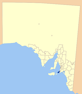
Location of the District Council of Yankalilla
Population
5,834 (LGA 2021)[1]
• Density
7,77/km2 (2,010/sq mi)
Established
1856
Area
750.6 km2 (289.8 sq mi)
Mayor
Darryl Houston
Council seat
Yankalilla
Region
Fleurieu and Kangaroo Island[2]
State electorate(s)
Finniss[3]
Mawson[4]
Federal division(s)
Mayo[5]
Website
District Council of Yankalilla
LGAs around District Council of Yankalilla:
City of Onkaparinga
Alexandrina Council
District Council of Yankalilla
City of Victor Harbor
Kangaroo Island Council
The District Council of Yankalilla is a local government area centred on the town of Yankalilla on the Fleurieu Peninsula in South Australia.
It was created on 23 October 1856, when the District Council of Yankalilla and Myponga was divided into two. It later absorbed two other councils: the District Council of Myponga on 5 January 1888, one of a number of amalgamations mandated under the District Councils Act 1887, and later the District Council of Rapid Bay on 12 May 1932.[6]
The district has a rich history, as one of the earliest South Australian coastal settlements, and a wide range of agricultural activities having taken place. Today the district remains agricultural in nature, supplemented by tourism and forestry.
^Australian Bureau of Statistics (28 June 2022). "Yankalilla (Local Government Area)". Australian Census 2021 QuickStats. Retrieved 28 June 2022.
^"Fleurieu and Kangaroo Island SA Government region" (PDF). The Government of South Australia. Retrieved 10 October 2014.
^"District of Finniss Background Profile". ELECTORAL COMMISSION SA. Retrieved 2 August 2015.
^Mawson (Map). Electoral District Boundaries Commission. 2016. Retrieved 2 March 2018.
^"Federal electoral division of Mayo, boundary gazetted 16 December 2011" (PDF). Australian Electoral Commission. Retrieved 2 August 2015.
^Marsden, Susan (2012). "A History of South Australian Councils to 1936" (PDF). Local Government Association of South Australia. p. 41.
and 16 Related for: District Council of Yankalilla information
The DistrictCouncilofYankalilla is a local government area centred on the town ofYankalilla on the Fleurieu Peninsula in South Australia. It was created...
Life Society of South Australia Inc. A biennial Leafy Sea Dragon Festival is held within the boundaries of the DistrictCouncilofYankalilla in South Australia...
Christ Church Yankalilla website Shrine of Our Lady ofYankalilla on the DistrictCouncilofYankalilla website. Shrine of Our Lady ofYankalilla at MyTravelGuide...
areas: DistrictCouncilofYankalilla Victor Harbor City Alexandrina Council (excluding small portions on west and east flanks) DistrictCouncilof Mount...
federal division of Mayo, the state electoral districtof Mawson and the local government area of the DistrictCouncilofYankalilla. "Search result for...
areas of Alexandrina Council, the City of Onkaparinga, and the DistrictCouncilofYankalilla. Major localities in the district include Cape Jervis, Kingscote...
Alexandrina Council, the City of Victor Harbor, the Kangaroo Island Council and the DistrictCouncilofYankalilla. Limestone Coast consists of land in the...
Australia. It is located between the coastal towns of Second Valley and Normanville on Yankalilla Bay. The holiday resort was developed from around 1972...
Kangaroo Island - Alexandrina Council, Kangaroo Island Council, the City of Victor Harbor and the DistrictCouncilofYankalilla. Commodore Reserve, Basham...
the jurisdiction of the DistrictCouncilofYankalilla in South Australia. It is a festival of the environment, arts, and culture of the Fleurieu Peninsula...
largest South Australian LGAs, both exceeding 100,000 km2. Coorong DistrictCouncil and Loxton Waikerie are the next largest LGAs. The smallest LGAs are...
former City of Happy Valley and City of Noarlunga with part of the DistrictCouncilof Willunga. It adopted the City of Onkaparinga name from 22 December...
 Global Information