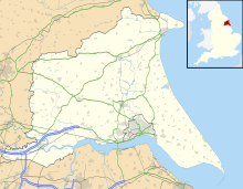
Derwent Ings is a Site of Special Scientific Interest (SSSI) divided between North Yorkshire and the East Riding of Yorkshire, England.[1] Derwent Ings is of international significance and has been designated a Wetland of International Importance under the Ramsar Convention[2] and as a Special Protection Area under the terms of the European Community Directive. Part of the site is owned by the Yorkshire Wildlife Trust[3] and is managed in conjunction with English Nature. It lies adjacent to the River Derwent between Sutton upon Derwent and Menthorpe. The site, which was designated a SSSI in 1975, consists of a series of neutral alluvial flood meadows, fen and swamp communities and freshwater habitats. It is one of the most important examples of agriculturally unimproved species-rich alluvial flood meadow habitat remaining in the UK.
In winter the Ings support internationally important concentrations of waterfowl, in excess of 20,000 individuals, together with nationally important numbers of Bewick's swan, teal, wigeon, mallard, pochard, golden plover and ruff.
^"Derwent Ings" (PDF). Natural England. 1988. Retrieved 21 July 2009.
^"Ramsar sites database". Archived from the original on 27 September 2009. Retrieved 1 December 2009.
^"Nature Reserves :Wheldrake Ings". Yorkshire Wildlife Trust. Archived from the original on 5 March 2009. Retrieved 21 July 2009.
DerwentIngs is a Site of Special Scientific Interest (SSSI) divided between North Yorkshire and the East Riding of Yorkshire, England. DerwentIngs is...
Ings, Bradford, Fairburn Ings RSPB reserve, Clifton Ings in York, DerwentIngs, Sutton Ings, Acaster South Ings, and Wetherby Ings), as well as in Cumbria...
south-east of York DerwentIngs, a Site of Special Scientific Interest (SSSI) in the East Riding of Yorkshire, England Upper Derwent Valley, an area of...
the River Derwent, 6 miles (10 km) east of Selby. Menthorpe Ings, north of the hamlet, is a flood meadow which is part of the DerwentIngs Site of Special...
Common, Heslington Tilmire, Askham Bog, Fulford Ings, Naburn Marsh, Church Ings, DerwentIngs and River Derwent. It is one of four riverside hay meadow SSSIs...
Minor coastal catchments River Waver (MS) River Ellen (MS) Derwent catchment River Derwent (MS) River Marron (L) Lostrigg Beck (L) River Cocker (L) Dash...
lead to higher soil fertility) and is especially characteristic of the DerwentIngs in Yorkshire. The following constant species are found in this community:...
one day was 53.8 mm. The Wheldrake Ings are part of the internationally significant nature reserve of the Lower Derwent Valley which is a site of special...
beck is also only 2.5 miles (4 km) west of the source of the River Derwent (Derwent Head), the river that the beck feeds into (via the Costa Beck at Wykeham)...
and winning", praising her convincing performance. She won a Clarence Derwent Award for Most Promising Female. Later, Hathaway voiced the audiobook release...
crockford.org.uk. Retrieved 2018-09-24. "The Benefice of Staveley (St James), Ings and Kentmere". www.crockford.org.uk. Retrieved 2018-09-24. "The Benefice...
Arts Gallery 1958 Beaux Arts Gallery 1960 Beaux Arts Gallery 1961 The Derwent Centre, Cockermouth 1962 Middlesbrough Art Gallery 1962 Beaux Arts Gallery...
the 20th century. The 18th century saw a canal network form, the River Derwent was canalised as far upstream as Malton and was linked to Pocklington by...
flat area of land in North Yorkshire, England. It is drained by the River Derwent. The landscape is rural with scattered villages and small market towns...
94..459R. doi:10.1007/s00114-006-0184-0. PMID 17149583. S2CID 22912889. Ings, Thomas C.; Raine, Nigel E.; Chittka, Lars (2009-06-01). "A Population Comparison...
portfolio to 252 homes in six UK cities. In late 2022, the Fund acquired Derwent House in Birmingham. In 2012, the company published a book documenting...
 Global Information