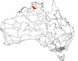
The interim Australian bioregions, with the Daly Basin in red
Area
20,922 km2 (8,078.0 sq mi)
Localities around Daly Basin:
Darwin Coastal
Darwin Coastal
Arnhem Plateau
Victoria Bonaparte
Daly Basin
Central Arnhem
Ord Victoria Plain
Sturt Plateau
Gulf Fall and Upland
The Daly Basin, an interim Australian bioregion, is located in the Northern Territory,[1][2] comprising an area of 2,092,229 hectares (5,170,010 acres)[3] of central Arnhem Land in the Top End of the Northern Territory.[4]
The bioregion includes gently undulating plains with scattered low plateau remnants and some rocky hills and gorges along its western edge. The dominant vegetation is Darwin woolybutt (Eucalyptus miniata) and stringybark open forests. Land uses include extensive grazing, intensive horticulture, and tourism. There are also areas of Aboriginal land. The major population centre is Katherine.[4]
^Environment Australia. "Revision of the Interim Biogeographic Regionalisation for Australia (IBRA) and Development of Version 5.1 - Summary Report". Department of the Environment and Water Resources, Australian Government. Archived from the original on 5 September 2006. Retrieved 31 January 2007. {{cite journal}}: Cite journal requires |journal= (help)
^IBRA Version 6.1 Archived September 8, 2006, at the Wayback Machine data
^"Interim Biogeographic Regionalisation for Australia (IBRA7) regions and codes". Department of Sustainability, Environment, Water, Population and Communities. Commonwealth of Australia. 2012. Retrieved 13 January 2013.
^ ab"Daly Basin bioregion" (PDF). Department of the Environment. Australian Government. Retrieved 1 June 2015.
The DalyBasin, an interim Australian bioregion, is located in the Northern Territory, comprising an area of 2,092,229 hectares (5,170,010 acres) of central...
African tectonics. Daly is an alumnus of Harvard Business School's Program for Management Development. Daly, M. C., et al. 2018. Cratonic Basin Formation: A...
for plants found in the DalyBasin bioregion. "Ziziphus-quadrilocularis". Fire responses for plants found in the DalyBasin bioregion. North Australian...
The Great Basin (Spanish: Gran Cuenca) is the largest area of contiguous endorheic watersheds, those with no outlets to the ocean, in North America. It...
Ocean from those that flow west into the drainage of the Murray–Darling Basin (and thence to the Southern Ocean) or into inland waters, such as Lake Eyre...
used for grazing sheep running north to the plains of the Darling River basin and the New South Wales–Queensland border. Rivers of the savanna include...
ecoregion, lying north of the Great Dividing Range and the Grampians, is in the basin of the Murray River. The southern portion of the ecoregion, south and east...
IBRA code Area States Location in Australia DalyBasin DAB 2,092,229 hectares (5,170,010 acres) NT DalyBasin DAB01 Dampierland DAL 8,360,871 hectares (20...
Willandra lakes, and Gunnaramby Swamp. The original vegetation of the basin was mallee eucalyptus woodlands with thicker black box (Eucalyptus largiflorens)...
of: the Arnhem Coast, the Arnhem Plateau, the Central Kimberley, the DalyBasin, Dampierland, Darwin Coastal, Gulf Coastal, Gulf Fall and Uplands, Northern...
Bonaparte: Timor Sea Darwin Coastal Darwin Coastal Northern Kimberley Victoria Bonaparte DalyBasin Central Kimberley Ord Victoria Plain Sturt Plateau...
of Arnhem Coast, Arnhem Plateau, Cape York Peninsula, Central Arnhem, DalyBasin, Darwin Coastal, Gulf Fall and Uplands, Northern Kimberley, Ord Victoria...
 Global Information