August 1928 (as Main Road 13, Pennant Hills Road)[2] August 1988 (as State Highway 13, Cumberland Highway)[3]
Route number(s)
A28 (2013–present) Entire length
Concurrency:
A40 (2013–present) (North Parramatta–Constitution Hill)
Former route number
See Pennant Hills Road (Wahroonga–North Parramatta)
State Route 40 (2007–2013)
Metroad 7 (1993–2005)
State Route 77 (1988–1993)
State Route 53 (1977–1988)
(North Parramatta–Constitution Hill)
Metroad 7 (1993–2005)
State Route 77 (1988–1993)
(Constitution Hill–Liverpool)
Major junctions
Northeast end
Pacific Highway Wahroonga, Sydney
Pacific Motorway
NorthConnex
M2 Hills Motorway
Marsden Road
James Ruse Drive
Windsor Road
Old Windsor Road
Great Western Highway
M4 Western Motorway
Southwest end
Hume Highway Liverpool, Sydney
Highway system
Highways in Australia
National Highway • Freeways in Australia
Highways in New South Wales
----
Infobox instructions
guidelines
examples
talk
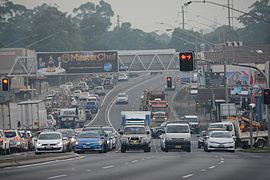
Cumberland Highway is a 34-kilometre (21 mi) long[1] urban highway located in Sydney, New South Wales, Australia. The highway links Pacific Highway and Pacific Motorway (M1) at Pearces Corner, Wahroonga in the northeast with Hume Highway at Liverpool in the southwest. This name covers a few consecutive roads and is widely known to most drivers, but the entire allocation is also known – and signposted – by the names of its constituent parts: Pennant Hills Road, James Ruse Drive, Briens Road, Old Windsor Road, Hart Drive, Freame Street, Emert Street, Jersey Road, Betts Road, Warren Road, Smithfield Road, Palmerston Road, (New) Cambridge Street, Joseph Street and Orange Grove Road. The entire length of Cumberland Highway is designated part of route A28.
The name of the highway is derived from the Cumberland Plain and Cumberland County. The name Cumberland was conferred on the county by Governor Arthur Phillip in honour of Ernest Augustus, Duke of Cumberland.[4]
^ abGoogle (16 January 2023). "Cumberland Highway" (Map). Google Maps. Google. Retrieved 16 January 2023.
^"Main Roads Act, 1924-1927". Government Gazette of the State of New South Wales. No. 110. 17 August 1928. pp. 3814–20. Archived from the original on 3 August 2022. Retrieved 1 August 2022 – via National Library of Australia.
^"State Roads Act". Government Gazette of the State of New South Wales. No. 138. 26 August 1988. p. 4505. Archived from the original on 16 January 2023. Retrieved 16 January 2023 – via National Library of Australia.
^"Cumberland". Geographical Names Register (GNR) of NSW. Geographical Names Board of New South Wales. Retrieved 4 August 2013.
and 18 Related for: Cumberland Highway information
CumberlandHighway is a 34-kilometre (21 mi) long urban highway located in Sydney, New South Wales, Australia. The highway links Pacific Highway and Pacific...
The Cumberland Gap is a pass in the eastern United States through the long ridge of the Cumberland Mountains, within the Appalachian Mountains and near...
The National Road (also known as the Cumberland Road) was the first major improved highway in the United States built by the federal government. Built...
conflicting with those on other tracks. Overpasses near Barcelona CumberlandHighway overpasses a street in Sydney A high-capacity stack interchange: the...
tunnel opened to traffic in 1996 and replaced a section of highway through the Cumberland Gap that had earned the nickname "Massacre Mountain" due to...
as Grove Golf Club from 1991 until January 1998, is located on the CumberlandHighway (Orange Grove Road) in Liverpool, New South Wales, and is the new...
reserve is located between Merrylands Road, Paton Street and the CumberlandHighway in Merrylands. The park's landform is made up of two main topographic...
occur with the Great Western Highway / Parramatta Road (A22), A3 (A3), A6 (A6), Henry Lawson Drive, CumberlandHighway (A28), M5 Motorway (M5), Westlink...
small section at its southwestern end, it is a constituent part of CumberlandHighway, and is designated part of route A28. In 2015 NRMA members voted the...
meets CumberlandHighway at the intersection of Hart Drive in Constitution Hill and continues in a southeasterly direction as part of CumberlandHighway, before...
bushland area to the south of the park, near CumberlandHighway. The corner of Brenan Street and CumberlandHighway provides good viewing site for birdwatching...
Kentucky Official Highway and Parkway Map (PDF) (Map). c. 1:760,320. Frankfort: Kentucky Department of Transportation. Cumberland Parkway Toll Rates...
Padeniya A28 (Sydney), a road in Sydney which is commonly known as CumberlandHighway A-28 Hudson, a Lockheed World War II aircraft Aeroprakt A-28 Victor...
and Wrynose passes, from the Eskdale side, in 1913. In 1936, the CumberlandHighways Committee considered, and rejected, a proposal to make the pass more...
The town of Cumberland Gap, Tennessee, is located inside of the park's territory. The Cumberland Gap Visitor Center is located on U.S. Highway 25E just southeast...
ramps to and from the M2 Hills Motorway west of Pennant Hills Road/CumberlandHighway; connecting between NorthConnex and the eastern portion of the motorway...
Virginia. The two largest cities connected by the highway are Morgantown, West Virginia, and Cumberland, Maryland. Although the freeway serves no major...
CumberlandHighway links the Pacific Highway (A1/B83) and Pacific Motorway (M1) at Pearces Corner, Wahroonga in the northeast with the Hume Highway (A22/A28)...
 Global Information