Colne Valley was an urban district in the West Riding of Yorkshire, England between 1937 and 1974. It takes its name from the River Colne which rises above the town of Marsden and flows eastward towards Huddersfield.
Colne Valley Urban District was formed on 1 April 1937 following the abolition of many of the urban districts and reallocation of land surrounding Huddersfield and comprised the following former urban district areas:[2][1]
584 hectares (1,440 acres) of Golcar Urban District — population 7,875
404 hectares (1,000 acres) of Linthwaite Urban District — population 5,220
Marsden Urban District — 3,493 hectares (8,630 acres), population 5,723
Scammonden Urban District — 731 hectares (1,810 acres), population 394
Slaithwaite Urban District — 1,284 hectares (3,170 acres), population 5,183
Colne Valley UD was abolished under the Local Government Act 1972, becoming part of the Metropolitan Borough of Kirklees on 1 April 1974. No successor parish was created for the area, but its boundaries remain reflected in a ward of the same name on Kirklees Council.
The surrounding pre-1974 districts which now make up West Yorkshire
^ ab"Colne Valley UD". A Vision of Britain Through Time. GB Historical GIS / University of Portsmouth. Retrieved 22 August 2021.
^"Colne Valley Urban District". Huddersfield Exposed: Exploring the History of the Huddersfield Area. Retrieved 2 February 2023.
and 24 Related for: Colne Valley Urban District information
The ColneValley /ˈkoʊn/ is a steep sided valley on the east flank of the Pennine Hills in the English county of West Yorkshire. It takes its name from...
are mill towns in the ColneValley, Holme Valley, Calder Valley and Spen Valley. Those areas of the district with a more urban character bound Calderdale...
not be confused with the unrelated ColneValley around the River Colne near Huddersfield in West Yorkshire. Colne is close to the southern entrance to...
successive local authorities in the area until the abolition of ColneValleyUrbanDistrict Council in 1974. Slaithwaite was formerly a township and chapelry...
Retrieved 26 August 2009 A Vision of Britain Through Time : ColneValleyUrbanDistrict Archived 14 May 2011 at the Wayback Machine Retrieved 3 September...
Yorkshire, England. The building, which served as the offices of ColneValleyUrbanDistrict Council, is now a business centre. Following significant population...
The ColneValley Labour Union (CVLU) was a political party based in the ColneValley, in Yorkshire, in England. The first labour party organised on the...
and Rykemerysworth (1418). There was a settlement in this part of the ColneValley in the Stone Age. Rickmansworth was one of five manors with which the...
in London and in 1974 elsewhere. They generally arose where former urbandistricts, municipal boroughs or county boroughs were abolished and where no...
district in Berkshire, England. It lies within the historic boundaries of Buckinghamshire, and straddles two distributaries of the Colne, the Colne Brook...
Feltham was an urbandistrict in the former county of Middlesex, England from 1904 to 1965. As Middlesex was disbanded is 1965, Feltham now is a part of...
Sudbury, in the ColneValley. Halstead is an ancient community that developed initially on the hill to the north of the River Colne. The name Halstead...
to Dacorum. The new district was named "Three Rivers", referencing the rivers Chess, Colne, and Gade which flow through the district and have their confluence...
Kelvedon & Feering Rayne Silver End and Cressing Stour Valley North Stour Valley South The Colnes Three Fields Witham Central Witham North Witham South...
west of the M25 motorway, near Heathrow Airport; it also adjoins the ColneValley regional park. Historically in Middlesex, Poyle was transferred to Surrey...
This is a list of all the rural districts, urbandistricts and municipal boroughs in England as they existed prior to the entry into force of the Local...
now connected to the ColneValley and Halstead Railway at Haverhill, serving Castle Hedingham, Halstead and Chappel and Wakes Colne. The closure of the...
regained his seat on the UrbanDistrict Council, in addition to one on the Board of Guardians. However, the newly renamed ColneValley Socialist League followed...
an urbandistrict in the West Riding of Yorkshire, England between 1921 and 1974. It encompassed the towns of Conisbrough and Denaby Main. The Urban District...
Colne Town Hall is a municipal building in Albert Road, Colne, Lancashire, England. The town hall, which is the meeting place of Colne Town Council, is...
53°29′02″N 1°13′34″W / 53.484°N 1.226°W / 53.484; -1.226 Cudworth was an urbandistrict in the West Riding of Yorkshire, England between 1900 and 1974. It encompassed...
Baildon was an urbandistrict in the West Riding of Yorkshire, England between 1894 and 1974. It was enlarged on 1 April 1937 by gaining part of Wharfedale...
 Global Information
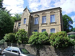
 Map of boundary as of 1960