This article needs additional citations for verification. Please help improve this article by adding citations to reliable sources. Unsourced material may be challenged and removed. Find sources: "Cobequid Bay" – news · newspapers · books · scholar · JSTOR(December 2009) (Learn how and when to remove this message)
Cobequid Bay
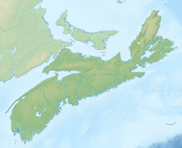
Aerial photograph of the Cobequid Bay at low tide, looking towards the East.
Cobequid Bay is an inlet of the Bay of Fundy and the easternmost part of the Minas Basin, located in the Canadian province of Nova Scotia. The bay was carved by rivers flowing into the eastern end of the Bay of Fundy.[1]
The eastern end of the bay hosts the estuary of the Salmon River, whereas the west end of the bay is less well-defined, typically delineated by Burntcoat Head on the southern shore and Five Islands or Economy Mountain on the northern shore.
The highest tidal range in the world was measured at Burntcoat Head where average tidal ranges measure a 12.4 m (41 ft) vertical difference in water level between low tide and high tide.
The bay's name is derived from the Acadian spelling of We'kopekwitk, the Mi'kmaq name for the area. Acadian settlers came to this area in the early 1700s.
The bay is an Important Bird Area.[2]
^Nova Scotia Museum of Natural History. "Geology and Landscape Development". Archived from the original on 2011-06-10. Retrieved 2011-09-18.
^"IBA Site Listing". www.ibacanada.org. Retrieved 2021-02-03.
CobequidBay is an inlet of the Bay of Fundy and the easternmost part of the Minas Basin, located in the Canadian province of Nova Scotia. The bay was...
side, mudflats are found on the southern side of the Minas Basin and in CobequidBay. In the Minas Basin, the size of the mudflats from low to high water...
The old name Cobequid was derived from the Mi'kmaq word "Wagobagitk" meaning "the bay runs far up", in reference to the area surrounding the easternmost...
the south shore of the CobequidBay, and Five Islands, Nova Scotia on the north shore. Lewis discovered that the rest of Cobequid was vacant. Most of those...
the Cobequid-Chedabucto Fault, extends along the southern portion of the Cobequid Mountains, immediately north of the Minas Basin and CobequidBay east...
Minas Passage to the mouth of CobequidBay, the shortest line point between Economy and the Noel Shore; (3) CobequidBay which extends to the mouth of...
approximately 500 people located along Trunk 2 and the north shore of CobequidBay in Colchester County, Nova Scotia. It is considered locally to incorporate...
along the north shoreline of the western end of CobequidBay north into the lower slopes of the Cobequid Mountains. Upper Economy is considered locally...
along the Minas Fault Zone, which runs east–west from Chedabucto Bay to CobequidBay. Nova Scotia has a great variety of coastal landforms. Most of the...
financially feasible: Shepody Bay (1550 MW), Cumberland Basin (1085 MW), and CobequidBay (3800 MW). These were never built despite their apparent feasibility...
Grand Lake to its mouth at the historic seaport village of Maitland on CobequidBay, site of the building of the William D. Lawrence, the largest wooden...
the bunker and were located on the shores of CobequidBay in nearby Masstown as well as in the Cobequid Hills near Londonderry. On February 1, 1968, the...
Owen to follow the Shubenacadie waterway from the Atlantic Ocean to CobequidBay. The Shubenacadie Canal was envisioned to facilitate transportation between...
a fault line (the Cobequid and Chedabucto faults) extending between the Bay of Fundy sub-basins of the Minas Basin and CobequidBay in the west, through...
Nova Scotia. Cobequid Cove (visited in the episode "The Dark and Scary Cove") shares its name with both the CobequidBay and the Cobequid Hills mountain...
northern part of the province around the Minas Basin and CobequidBay, sub-basins of the Bay of Fundy. The route connects Amherst in Cumberland County...
meaning "the bay runs far up", in reference to the area surrounding the easternmost inlet of the Minas Basin, a body of water called CobequidBay. The District...
settlers, known as Acadians. They first settled in this area near the CobequidBay in 1705 (319 years ago) (1705). The Acadian culture consisted primarily...
four on board. 6 October 1931: Heinkel HE 12 D-1717 New York crashed at CobequidBay, Nova Scotia in fog, killing all three on board. 29 July 1932: Junkers...
 Global Information