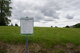
Clatsop Butte is an upland butte lying directly south of Powell Butte in southeast Portland, Oregon, United States. Clatsop Butte City Park, which occupies part of the butte, is at coordinates 45°28′28″N122°30′24″W / 45.47444°N 122.50667°W / 45.47444; -122.50667 at an elevation of 577 feet (176 m).[1] Johnson Creek, Southeast Foster Road, and the Springwater Corridor Trail pass between Powell Butte and Clatsop Butte near Southeast 152nd Avenue.[2]
The City of Portland acquired about 16 acres (6.5 ha) of land on the butte for a park and natural area in 2000.[3] Other land acquisitions increased the park's size to 102 acres (0.41 km2) by 2007 but led to controversy about public expenditures. A 16-member oversight committee was to review the purchases in 2008 to decide whether the money had been wisely spent.[4]
As of 2008, Metro the regional government in the Oregon part of the Portland metropolitan area, included 49 acres (20 ha) of the acreage on its list of protected natural areas. The natural area, comprising densely forested hillsides and creek frontage, supports wildlife including deer, foxes, coyotes, northern flickers, pileated woodpeckers and other local and migratory birds.[5]
^"Clatsop Butte City Park". Geographic Names Information System. United States Geological Survey, United States Department of the Interior. Retrieved 2020-01-28.
^City Street Map: Portland, Gresham (Map) (2007 ed.). G.M. Johnson and Associates.
^Parks and Recreation Department (2008). "Clatsop Butte Park". City of Portland. Retrieved 2008-04-28.
^Mortenson, Eric (December 17, 2007). "Good buys on green space?". The Oregonian. Retrieved 2008-04-28.
^"Metro to protect North side of Clatsop Butte via Natural Areas Program". Metro. 2008. Archived from the original on 2011-05-17. Retrieved 2008-04-28.
ClatsopButte is an upland butte lying directly south of Powell Butte in southeast Portland, Oregon, United States. ClatsopButte City Park, which occupies...
Lava Butte is a cinder cone in central Oregon, United States, just west of U.S. Route 97 between the towns of Bend, and Sunriver in Deschutes County....
Fort Clatsop was the encampment of the Lewis and Clark Expedition in the Oregon Country near the mouth of the Columbia River during the winter of 1805–1806...
Pelican Butte is a steep-sided shield volcano in the Cascade Range of southern Oregon. It is located 28 miles (45 km) due south of Crater Lake and 12...
Powell Butte is an extinct cinder cone butte in Portland, Oregon, United States. It is part of the Boring Lava Field, which includes more than 80 small...
volcanic plugs. Known subfeatures include two shield volcanoes, Maxwell Butte (less eroded than Three Fingered Jack) and Turpentine Peak, which have elevations...
Bone Mountain Boring Lava Field Cascade Head Chamberlain Hill ClatsopButte Cook's Butte Crescent Mountain Devil's Rest East Buttes French's Dome Elk Point...
Bone Mountain Boring Lava Field Cascade Head Chamberlain Hill ClatsopButte Cook's Butte Crescent Mountain Devil's Rest East Buttes French's Dome Elk Point...
Bone Mountain Boring Lava Field Cascade Head Chamberlain Hill ClatsopButte Cook's Butte Crescent Mountain Devil's Rest East Buttes French's Dome Elk Point...
Park, Utah Half Dome, Yosemite National Park, California Haystack Rock, Clatsop County, Oregon Looking Glass Rock, Transylvania County, North Carolina...
Hayrick Butte is a tuya, a type of subglacial volcano, in Linn County, Oregon. Located in the Willamette National Forest near Santiam Pass, it lies adjacent...
Damascus. Included are Gresham Butte (also known as Walter's Hill), Gabbert Hill, and Towle Butte. The Gresham Butte Saddle Trail runs through open space...
The Lewis and Clark National Historical Park (including the former Fort Clatsop National Memorial), located in the vicinity of the mouth of the Columbia...
Rocky Butte (previously known as Mowich Illahee and Wiberg Butte) is an extinct cinder cone butte in Portland, Oregon, United States. It is also part...
Roxy Ann Peak, also known as Roxy Ann Butte, is a 3,576-foot-tall (1,090 m) mountain in the Western Cascade Range at the eastern edge of Medford, Oregon...
Bone Mountain Boring Lava Field Cascade Head Chamberlain Hill ClatsopButte Cook's Butte Crescent Mountain Devil's Rest East Buttes French's Dome Elk Point...
years old. Hogg Rock lies south of Three Fingered Jack and north of Hayrick Butte, a somewhat larger tuya of similar age and composition. A tuya is a type...
Olallie Butte is a steep-sided shield volcano in the Cascade Range of the northern part of the U.S. state of Oregon. It is the largest volcano and highest...
Bone Mountain Boring Lava Field Cascade Head Chamberlain Hill ClatsopButte Cook's Butte Crescent Mountain Devil's Rest East Buttes French's Dome Elk Point...
Bone Mountain Boring Lava Field Cascade Head Chamberlain Hill ClatsopButte Cook's Butte Crescent Mountain Devil's Rest East Buttes French's Dome Elk Point...
Area located on the Matson Plateau west of the Deschutes River with Pilot Butte and Paulina Peak in the distance. "USGS Place Name: Cline Buttes" Archived...
 Global Information