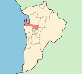
Location of Port Adelaide Enfield within the Adelaide metropolitan area
Population
132,400 (LGA 2021)[1]
• Density
1,576,2/km2 (40,820/sq mi)
Established
26 March 1996
Area
94 km2 (36.3 sq mi)
Mayor
Claire Boan
Council seat
Port Adelaide
Region
Western Adelaide[2] Northern Adelaide[3]
State electorate(s)
Port Adelaide, Lee, Cheltenham, Croydon, Playford, Enfield, Torrens, Florey, Dunstan
Federal division(s)
Port Adelaide, Adelaide, Makin, Sturt
Website
City of Port Adelaide Enfield
LGAs around City of Port Adelaide Enfield:
Salisbury
Tea Tree Gully
City of Port Adelaide Enfield
Campbelltown
Charles Sturt, Prospect, Walkerville
Norwood Payneham & St Peters
The City of Port Adelaide Enfield (PAE),[5] located across inner north and north-western suburbs of Adelaide, is one of the largest metropolitan councils within South Australia. It was established on 26 March 1996 by the amalgamation of the City of Port Adelaide and the City of Enfield.
Extending from the River Torrens to Outer Harbor, and covering an area of approximately 97 km2, Port Adelaide Enfield contains some of South Australia's finest historical buildings and landmarks. The Port Adelaide area is known as the History Precinct, as it is home to the Maritime Museum, the National Railway Museum and the Aviation Museum.
As of March 2024[update], the current Mayor is Claire Boan,[5] who was elected in 2018.[6] There are 17 ward councillors who represent the residents and businesses of their wards at council meetings.
^Australian Bureau of Statistics (28 June 2022). "Port Adelaide Enfield (Local Government Area)". Australian Census 2021 QuickStats. Retrieved 28 June 2022.
^"Western Adelaide SA Government region" (PDF). The Government of South Australia. Archived from the original (PDF) on 22 March 2017. Retrieved 17 April 2017.
^"Northern Adelaide SA Government region" (PDF). The Government of South Australia. Retrieved 17 April 2017.
^"3218.0 – Regional Population Growth, Australia, 2017-18". Australian Bureau of Statistics. 27 March 2019. Retrieved 31 December 2019. Estimated resident population (ERP) at 30 June 2018.
^ abCity of Port Adelaide Enfield, PAE Today, Issue 19, Autumn 2024
^2018 Council Election Results > Port Adelaide Enfield - Mayor Electoral Commission SA. Retrieved 15 November 2018.
and 13 Related for: City of Port Adelaide Enfield information
CityofPortAdelaideEnfield council, a suburb, a federal and state electoral division and is the main port for the cityofAdelaide. PortAdelaide played...
the City of Playford, the Cityof Salisbury, the Cityof Tea Tree Gully and the east half of the CityofPortAdelaideEnfield. Dauntsey Reserve BMX Skate...
This is a list of the suburbs ofAdelaide, the capital cityof South Australia, with their postcodes and local government areas (LGAs). This article does...
Playford, Cityof Tea Tree Gully and CityofPortAdelaideEnfield. Encompassing an area of 158 square kilometres (61 square miles), the city is one of the...
5-hectare reserve in the suburb ofEnfield, South Australia. It is owned by the CityofPortAdelaideEnfield, and consists of significant remnant vegetation...
CityofPortAdelaideEnfield. p. 20. Retrieved 15 January 2016. List of names on PortAdelaide Workers Memorial (PortAdelaide Enviropedia) Port Adelaide...
 Global Information