This article is about the local government area known as Mount Gambier. For other uses, see Mount Gambier (disambiguation).
Local government area in South Australia
City of Mount Gambier South Australia
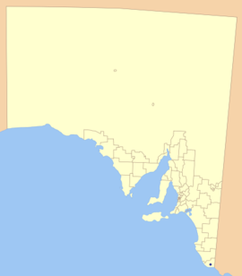
Location of the City of Mount Gambier in blue
Population
26,276 (2016 census)[1]
• Density
85.31/km2 (221.0/sq mi)
Established
1876
Area
308 km2 (118.9 sq mi)
Mayor
Lynette Martin
Council seat
Mount Gambier
Region
Limestone Coast[2]
State electorate(s)
Mount Gambier
Federal division(s)
Barker
Website
City of Mount Gambier
LGAs around City of Mount Gambier:
Grant
Grant
Grant
Grant
City of Mount Gambier
Grant
Grant
Grant
Grant
The City of Mount Gambier is a local government area centred in Mount Gambier in the Limestone Coast region of South Australia. While it is the southernmost city council in the state, the District Council of Grant is the southernmost council because it completely surrounds but does not include the city of Mount Gambier. It was established on 25 May 1876 as the Corporate Town of Mount Gambier, and became the City of Mount Gambier when it gained city status in 1955.[3][4]
City of Mount Gambier Council Chambers and offices
The city consists of a mayor and eight councillors, elected equally from the East and West wards once every four years by postal voting. In addition to Mount Gambier itself, the council also includes parts of Glenburnie, OB Flat, Suttontown and Worrolong, all shared with the District Council of Grant.[5] Due to the City being entirely surrounded by the District Council of Grant and the growth of Mount Gambier, there have been ongoing talks of amalgamation, with the most recent boundary changes taking place in 2010.[6]
^Australian Bureau of Statistics (27 June 2017). "Mount Gambier (C)". 2016 Census QuickStats. Retrieved 29 November 2017.
^"Limestone Coast SA Government region" (PDF). The Government of South Australia. Retrieved 10 October 2014.
^Marsden, Susan (2012). "A History of South Australian Councils to 1936" (PDF). Local Government Association of South Australia. p. 41. Archived from the original (PDF) on 17 March 2016. Retrieved 30 October 2015.
^"Mount Gambier City Status Celebrations". State Library of South Australia. Retrieved 9 April 2016.
^"Search result for "Mount Gambier (Locality Bounded)" (Record no SA0046869 ) with the following layers selected - "Suburbs and Localities" and "Local Government Areas"". Department of Planning, Transport and Infrastructure. 31 March 2010. Archived from the original on 12 October 2016. Retrieved 7 March 2016.
^"Consolidation in Local Government: A Fresh Look - City of Mount Gambier and District Council of Grant | IKEN". Archived from the original on 30 December 2012. Retrieved 18 October 2012.
and 22 Related for: City of Mount Gambier information
The CityofMountGambier is a local government area centred in MountGambier in the Limestone Coast region of South Australia. While it is the southernmost...
MountGambier is the second most populated city in South Australia, with an estimated urban population of 33,233 as of 2021[update]. The city is located...
MountGambier Gaol is a heritage-listed former prison and now converted accommodation and events venue in MountGambier, South Australia. It is listed...
MountGambier railway station was the junction station for the Naracoorte–Millicent and MountGambier-Heywood lines in the South Australian cityof Mount...
Council of Grant CityofMountGambier The County of Grey is divided into the following 21 hundreds: Hundred of Lake George (Lake George) Hundred of Symon...
amalgamation of the District Council ofMountGambier and the District Council of Port MacDonnell, and currently surrounds the CityofMountGambier. The economy...
government areas located in the south east of the state: the CityofMountGambier and the District Councils of Grant, Kingston, Robe, Tatiara and Naracoorte...
containing the CityofMountGambier and District Council of Grant local government areas. It is centred on the city and extinct volcano ofMountGambier. The electorate...
such as MountGambier have strong economic benefits for its local inhabitants, namely the residents of the cityMountGambier. The economic value of the land...
MountGambier Regional Airport (IATA: MGB, ICAO: YMTG) is an airport in the Limestone Coast, South Australia. It is located on the Riddoch Highway in...
north-west of the city of Mount Gambier, only a few metres from the Princes Highway (Route B1) between MountGambier and Millicent. It is popular with...
Mount Gambier urban area. It is owned by the local government area ofCityofMountGambier and has been developed as a tourism venue. Its dry extent is notable...
Mount Schank is a 100 m (330 ft) high dormant volcano in the southeast corner of South Australia, near MountGambier. It was sighted by James Grant on...
miles) southeast of the state capital of Adelaide and 138 kilometres (86 miles) north-west of the centre of the cityofMountGambier. At the 2021 census...
is a south-eastern suburb ofMountGambier in South Australia. The name for this suburb is believed to derive from a herd of cattle bearing the brand "OB"...
he was named one of InDaily's inaugural "40 under 40". Hood has served as a councillor and deputy mayor for the CityofMountGambier and as an inaugural...
UCLs are not an official definition of towns. Suburbs of Adelaide are not included, with the exception of Gawler, Mount Barker, Crafers-Bridgewater and Nairne...
 Global Information