This article is about the district. For its eponymous headquarters, see Chhindwara.
District in Madhya Pradesh, India
Chhindwara district
District
Top: Badal Mahal, Deogarh Fort Bottom: Pench National Park
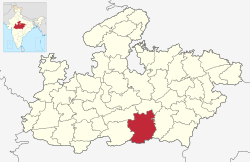
Location of Chhindwara district in Madhya Pradesh
Country
India
State
Madhya Pradesh
Division
Jabalpur
Established
1 November 1956[1]
Headquarters
Chhindwara
Tehsils
11
Government
• Lok Sabha constituencies
Chhindwara
Area
• Total
10,293 km2 (3,974 sq mi)
Population
(2011)
• Total
374,310
• Density
36/km2 (94/sq mi)
Demographics
• Literacy
72.21%
• Sex ratio
966
Time zone
UTC+05:30 (IST)
Major highways
47, 347, 547
Website
chhindwaranagarnigam.com, chhindwara.nic.in
Map of Chhindwara District
Chhindwara district is one of the major districts of Madhya Pradesh state of India, and Chhindwara town is the district headquarters. Chhindwara was the largest district in Madhya Pradesh with an area of 10,293 square km before the bifurcation of Pandhurna district. The district is part of Jabalpur division.
The name Chhindwara has been derived from the word Chhind, the local name of a tree found commonly in the district. Chhindwara district was formed on 1 November 1956.[1]
It is on the southwest region of the Satpura Range.[1] It is spread from 21.28 to 22.49 deg. North (latitude) and 78.40 to 79.24 deg. East (longitude) and spread over an area of 11,815 km2. This district is bound by the plains of Pandhurna district and Nagpur district (in Maharashtra State) on the south, Narmadapuram and Narsinghpur districts on the north, Betul district on the west and Seoni district on the east.[1]
^ abcdMSME-Development Institute. "Brief Industrial Profile of Chindwara District, Madhya Pradesh" (PDF). Ministry of Micro, Small and Medium Enterprises (MSME), Government of India. Archived (PDF) from the original on 24 January 2013.
and 27 Related for: Chhindwara district information
Chhindwaradistrict is one of the major districts of Madhya Pradesh state of India, and Chhindwara town is the district headquarters. Chhindwara was the...
Chhindwara is a city in India and a Municipal Corporation in Chhindwaradistrict in the Indian state of Madhya Pradesh. The city is the administrative...
existence in 1951, and it presently covers the entire Chhindwaradistrict and Pandhurna district. Most Lok Sabha seats in MP and Chhattisgarh, with few...
district of Madhya Pradesh state and 9th district of Jabalpur division, which came into existence in the year 2023 after separating from Chhindwara district...
part of ChhindwaraDistrict. Kamal Nath, the former Chief Minister of Madhya Pradesh, is the incumbent MLA of this constituency. by poll Chhindwara "Madhya...
Chhindwara Junction railway station serves Chhindwara in Chhindwaradistrict in the Indian state of Madhya Pradesh. Chhindwara was part of the Satpura...
and with the Maharashtra districts of Nagpur to the northeast, Chhindwaradistrict of Madhya Pradesh to the northeast Wardha to the east, Yavatmal to...
The district has an area of 5408.23 km2. Hoshangabad district is bounded by the districts of Raisen to the north, Narsinghpur to the east, Chhindwara to...
municipality in Chhindwaradistrict in the Indian state of Madhya Pradesh. It is the administrative headquarters of ChhindwaraDistrict. Chhindwara is reachable...
Chandrapur district on the southeast, Wardha district on the southwest, Amravati district on the northwest and Chhindwaradistrict and Seoni district of Madhya...
a city in Rajsamand District of India's Rajasthan state Devgarh, Madhya Pradesh, an historic fortress-city in ChhindwaraDistrict of India's Madhya Pradesh...
is an Indian tributary of the Kanhan River. It originates in the Chhindwaradistrict of Madhya Pradesh and flows across Pench National Park, which is...
western and eastern halves, the well-forested areas of Seoni and Chhindwaradistricts respectively. It was declared a sanctuary in 1965, raised to the...
and social worker and a former member of parliament elected from the Chhindwara constituency in the Indian state of Madhya Pradesh as an Indian National...
present day town of Devgarh, at a distance of 42 km from the district headquarter Chhindwara. It sprawls over a hill 650 m (2132.55 ft) in height and spread...
the Park into two, and forming the boundary of Seoni District and ChhindwaraDistrictdistricts of Madhya Pradesh. The Meghdoot dam built across Pench...
southern spurs of the Satpura Range in the north-western region of ChhindwaraDistrict. Flowing south from its origin, Damua is the first town it encounters...
Biosphere Reserve is located within areas of Narmadapuram, Betul, and ChhindwaraDistricts in Madhya Pradesh. The biosphere reserve's total area is 4,926.28...
The Gonds of central India: The Material Culture of the Gonds of ChhindwaraDistrict, Madhya Pradesh. London: British Museum, 1973 Geoffrey Waring Maw...
among the tribals of central India. She lives in Barul village of Chhindwaradistrict in Madhya Pradesh. Mercy Mathew hails from a prosperous Christian...
formerly known as Dongar Parasia, is a tehsil and a municipality in Chhindwaradistrict in the state of Madhya Pradesh, India. [needs update] As of the 2011...
region and is bordered by Jabalpur district on the north, Narsinghpur and Chhindwaradistricts to the west, Nagpur district of Maharashtra to the south and...
incorrectly declared that Vidhi Suryavanshi of Madhya Pradesh’s Chhindwaradistrict had only scored 6 marks which were later found out to be false after...
1999 Pachmarhi Biosphere Reserve Parts of Betul District, Hoshangabad District and ChhindwaraDistrict Madhya Pradesh Semi-Arid Giant squirrel, flying...
airstrip is 55 km away in Chhindwara. Rail Sausar Railway station SASR has regular trains from Nagpur Junction to Chhindwara making it reachable from every...
 Global Information