Global Information Lookup Global Information

Chaudhara information


Chaudhara
Chaudhara is located in Uttarakhand
Chaudhara
Chaudhara
Location in northern India
Chaudhara is located in Tibet
Chaudhara
Chaudhara
Chaudhara (Tibet)
Chaudhara is located in India
Chaudhara
Chaudhara
Chaudhara (India)
Highest point
Elevation6,510 m (21,360 ft)
ListingList of mountains in India
Coordinates30°16′48″N 80°22′12″E / 30.28000°N 80.37000°E / 30.28000; 80.37000
Geography
LocationPithoragarh, Uttarakhand, India
Parent rangeKumaon Himalaya
Climbing
First ascentA.R.Chandekar and Sherpa Ajeeba in 1973
Easiest routeWest Face
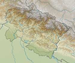
Map

Chaudhara is a Himalayan mountain peak, situated in the Pithoragarh district of Kumaon, India. The altitude of the peak is 6,510 m.[1] The peak lies to the south of Ralam pass and north west of Panchchuli. The peak is so named due to the peak having four corners. The peak was climbed for the first time by an Indian team led by A.R.Chandekar and Sherpa Ajeeba in 1973. Rajrambha is its neighbouring peak. Chaudhara is situated at the south east end of Kalabaland Glacier-Sankalp Glacier-Yangchar Glacier group. Chaudhara is the part of Himalayan massif between Ralam and Lassar valley. The most popular route to the summit is via the west face.

  1. ^ Club, American Alpine. The American Alpine Journal. The Mountaineers Books. pp. 256–. ISBN 9780930410438. Retrieved 5 February 2013.

and 6 Related for: Chaudhara information

Request time (Page generated in 0.5325 seconds.)

Chaudhara

Last Update:

Chaudhara is a Himalayan mountain peak, situated in the Pithoragarh district of Kumaon, India. The altitude of the peak is 6,510 m. The peak lies to the...

Word Count : 152

List of mountains in India

Last Update:

Betlingchhip Blue Mountain Brammah Burphu Dhura Chandrashila Changuch Chaudhara Chiring We Churdhar Deo Tibba Deomali Doddabetta Doli Gutta Gangotri Group...

Word Count : 547

List of mountain peaks of Uttarakhand

Last Update:

/ 30.88194°N 79.13361°E / 30.88194; 79.13361 6,512 21,365 Gangotri Chaudhara Kumaon Pithoragarh 30°16′48″N 80°22′12″E / 30.28000°N 80.37000°E /...

Word Count : 306

Pithoragarh district

Last Update:

Panchchuli II 6,904 Nanda Kot 6,861 Chiring We 6,559 Rajrambha 6,537 Chaudhara 6,510 Sangthang 6,480 Panchchuli V 6,437 Nagalaphu 6,410 Suitilla (Suj...

Word Count : 1933

Gori Ganga

Last Update:

and those flowing west from the high peaks of Panchchuli, Rajramba, and Chaudhara, including the Ralam Gad and the Pyunsani Gadhera. The Kalabaland-Burfu...

Word Count : 452

Rajrambha

Last Update:

nearby peaks which form the north–south massif are Suitilla 6,373 m, Chaudhara 6,510 m, and Ngalaphu 6,410 m. Rajrambha forms a wall between Lasser Yankti...

Word Count : 155

PDF Search Engine © AllGlobal.net