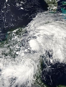
Central American gyres can produce tropical cyclones (precursor to Hurricane Michael shown).
The Central American gyre (CAG) is a broad and seasonal area of low pressure that occurs over the eastern Pacific Ocean and western Caribbean Sea. It primarily develops annually during the region's rainy season between May and November, and most commonly occurs during late spring (May–June) and early fall (October–November).[1][2]: 1999 CAGs are a type of monsoonal low and share similarities with monsoonal lows in other oceanic basins.[2]: 1983 The broad counterclockwise circulation of winds associated with CAGs is weak.[3][4] CAGs may span across hundreds of miles,[3] potentially covering parts of the eastern Pacific Ocean, southern Gulf of Mexico, and western Caribbean Sea.[5]
CAGs are also slow-moving and can last on the order of days to weeks as they move over Central America and persistently generate inclement weather.[3][4][6] Consequently, with the aid of the nearby ocean waters,[7] CAGs can produce prolific amounts of rainfall over Central America, presenting a risk for flash floods and mudslides.[1][8] The terrain of Central America may influence the development and organization of the showers and thunderstorms associated with CAGs.[2]: 1999 On average, precipitation associated with CAGs most commonly occurs along the coast of Central America.[2]: 1983 Tropical cyclones over the western Caribbean Sea and southern Gulf of Mexico may draw moisture from a nearby CAG, enhancing the amount of rainfall they produce.[9] The presence of a CAG may also push rainfall associated with tropical cyclones in the southern Gulf of Mexico towards the south and west.[10]
^ abCite error: The named reference WhatIsCAG was invoked but never defined (see the help page).
^ abcdCite error: The named reference Papin et al. 2017 was invoked but never defined (see the help page).
^ abcHenson, Bob (29 May 2020). "Watching the Gyre: Serious Flood Threat in Central America, Tropical Cyclones Possible on Either Side". Category 6. Weather Underground. Retrieved 4 January 2024.
^ abSosnowski, Alex (16 October 2020). "The weather pattern fueling much of 2020's wild hurricane season". AccuWeather. Retrieved 4 January 2024.
^Sonowski, Alex (15 June 2023) [12 June 2023]. "Busy tropical wave train among factors pointing to uptick in Atlantic activity". AccuWeather. Retrieved 4 January 2024.
^Cite error: The named reference ExploringCAG was invoked but never defined (see the help page).
^Van Dam, Derek (30 May 2020). "Central America faces major flood threat". CNN. Retrieved 4 January 2024.
^Cite error: The named reference CAGTrigger was invoked but never defined (see the help page).
^Zhou, Yao; Matyas, Corene J. (19 May 2021). "Regionalization of precipitation associated with tropical cyclones using spatial metrics and satellite precipitation". GIScience & Remote Sensing. 58 (4): 542–561. Bibcode:2021GISRS..58..542Z. doi:10.1080/15481603.2021.1908675.
^Zhou, Yao; Matyas, Corene J. (August 2018). "Spatial Characteristics of Rain Fields Associated with Tropical Cyclones Landfalling over the Western Gulf of Mexico and Caribbean Sea". Journal of Applied Meteorology and Climatology. 57 (8): 1711–1727. Bibcode:2018JApMC..57.1711Z. doi:10.1175/JAMC-D-18-0034.1.
and 25 Related for: Central American gyre information
North Atlantic gyre North Atlantic gyre North Atlantic gyre Indian Ocean gyre North Pacific gyre South Pacific gyre South Atlantic gyre In oceanography...
Atlantic Gyre of the Atlantic Ocean is one of five great oceanic gyres. It is a circular ocean current, with offshoot eddies and sub-gyres, across the...
Pacific Gyre (NPG) or North Pacific Subtropical Gyre (NPSG), located in the northern Pacific Ocean, is one of the five major oceanic gyres. This gyre covers...
North Pacific garbage patch) is a garbage patch, a gyre of marine debris particles, in the central North Pacific Ocean. It is located roughly from 135°W...
caused the pre-existing disturbance that was being enhanced by a CentralAmericanGyre (CAG) to become more organized. By May 30, the system attained a...
deadliest in Puerto Rico since the 1899 San Ciriaco hurricane. A CentralAmericangyre and a tropical wave interacted, spawning a tropical depression about...
remnants of Hurricane Agatha in the Pacific basin interacted with a CentralAmericanGyre. Consequently, a gradual increase in deep convection occurred over...
an extended period of heavy rain associated with a long-lived CentralAmericangyre led to disaster. Particularly hard-hit were Honduras and Nicaragua...
North Atlantic gyre North Atlantic gyre North Atlantic gyre Indian Ocean gyre North Pacific gyre South Pacific gyre South Atlantic gyre The clockwise...
dissipated on June 23 to the southeast of Nova Scotia. The precursor CentralAmericangyre, which also contributed to the development of Tropical Storm Dolores...
into a Central Americangyre—a broad monsoonal circulation. A tropical wave crossed the Caribbean and eventually reached CentralAmerica on October 15;...
Continued flow between the ridge over the western Atlantic and the CentralAmericangyre propelled Nate into the Yucatán Channel and then the Gulf of Mexico...
convection occurred as the wave crossed CentralAmerica, partially due to interaction with the CentralAmericangyre. The wave split, with the southern portion...
reanalysis concluded that the remnants of Hattie instead became a CentralAmericangyre. Hattie first affected regions in the southwestern Caribbean, producing...
Gyre – Subtropical gyre in the south Atlantic Ocean South Pacific Gyre – Major circulating system of ocean currents Weddell Gyre – One of two gyres within...
referred as a CentralAmericangyre; as it lacked a well-defined center, the system was removed as a tropical cyclone in 2019. The gyre intensified before...
southern part of the North Pacific Subpolar Gyre and the northern part of the North Pacific Subtropical Gyre. The North Pacific Current is formed by the...
southern Panthalassa, the four currents of the subtropical gyre, the South Panthalassa Gyre, rotated counterclockwise. The South Equatorial Panthalassa...
A garbage patch is a gyre of marine debris particles caused by the effects of ocean currents and increasing plastic pollution by human populations. These...
also increases, bringing humidity to central and southeast Brazil. As the SAMS progresses a continental-scale gyre transports moisture westward from the...
it means: "to make holes like a gimlet." Gyre: "To 'gyre' is to go round and round like a gyroscope." Gyre is entered in the OED from 1420, meaning a...
The Weddell Sea is part of the Southern Ocean and contains the Weddell Gyre. Its land boundaries are defined by the bay formed from the coasts of Coats...
Point Nemo is relatively lifeless; its location within the South Pacific Gyre blocks nutrients from reaching the area, and being so far from land it gets...
 Global Information