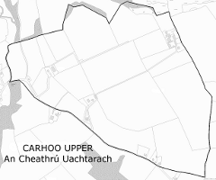
Carhoo Upper (from Irish An Cheathrú Uachtarach) is a townland within the civil parish of Magourney and catholic parish of Aghabullogue, County Cork, Ireland. It is 199.08 acres (80.56 ha) in size, and west of Coachford village.
Carhoo firstly appears c. 1590 as 'Carown' in a sketch map The description of Muskery, retained as part of the Dartmouth Map Collection, at the National Maritime Museum, Greenwich.[1] In the Down Survey Maps (1656-8), it is referred to as 'Carrow' [2] and 'Carrooe', and the accompanying terrier lists Thomas and Edmund Coppinger as proprietors by way of mortgage.[3] The Ordnance Survey name book (c. 1840) describes Carhoo Upper as bounded on the north by Rockgrove townland and on the west by Aghinagh parish. Townland name versions include 'Carhoo' and 'Carhue'. O'Murchú (1991) holds Ceathrú as meaning a quarter, in this instance a measurement of land, such as a townland or ploughland, and being a smaller division than a tuath or triocha céad.[4] The Placenames Database of Ireland gives the townland an Irish name of An Cheathrú Uachtarach, with Ceathrú meaning a quarterland.[5]
Townland population
Year
Pop.
1841
127 [6][7]
1851
53 [6]
1861
44 [6]
1871
32 [6]
1881
18 [6]
1891
28 [8]
1901
22 [8]
1911
20 [8]
Earlier versions of townland name
Year
Form
c. 1590
Carown (Sketch map of Muskery)
1656-8
Carrow/Carrooe (Down Survey)
1811
Carhue (Bath's Grand Jury map)[9]
1840
Carhue/Carhoo (OS name book)
^"The description of Muskery, Dartmouth map collection, Royal Museums Greenwich". Retrieved 24 February 2014.
^"Down Survey map 1656-8 (Barony of Muskery)". Retrieved 5 March 2014.
^"Down Survey map 1656-8 (Ahabollog and Aghinagh)". Retrieved 5 March 2014.
^O'Murchú, M. (December 1991). "Place names of the parish of Aghabullogue". Coachford Record. 2.
^"Placenames Database of Ireland". Archived from the original on 28 February 2014. Retrieved 24 February 2014.
^ abcdeCite error: The named reference HistPop1881 was invoked but never defined (see the help page).
^"1841 Census appears to include the population of adjoining Rockgrove townland within Carhoo Upper".
^ abcCite error: The named reference HistPop1911 was invoked but never defined (see the help page).
^"Grand Jury map of County Cork" (PDF). Retrieved 24 February 2014.
CarhooUpper (from Irish An Cheathrú Uachtarach) is a townland within the civil parish of Magourney and catholic parish of Aghabullogue, County Cork, Ireland...
Carhoo may refer to the following places in the Republic of Ireland: Carhoo Hill Carhoo Lower CarhooUpper This disambiguation page lists articles about...
Ordnance Survey name book (c. 1840) describes Carhoo Lower as bounded on the north and east by CarhooUpper and Leemount townlands, with a large portion...
village. It is located at a meeting point of four townlands (Carhoo Lower, CarhooUpper, Carrigathou and Coolnagearagh) and two civil parishes (Aghinagh...
Carhue House (also known as Carhoo House) is a country house in the townland of Carhoo Lower, situated 2.2 km (1.4 mi) west of Coachford village. It is...
though the Irish is in smaller, italicised font, while the English is in all upper case. However, in the Gaeltacht, the English/anglicized names have no official...
 Global Information