Location in the Andaman and Nicobar Islands and in the Bay of Bengal
Show map of Andaman and Nicobar Islands
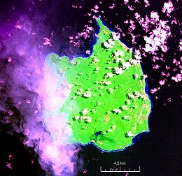
Car Nicobar
Car Nicobar (Bay of Bengal)
Show map of Bay of Bengal
Geography
Location
Bay of Bengal
Coordinates
9°10′N92°47′E / 9.17°N 92.78°E / 9.17; 92.78
Archipelago
Nicobar Islands
Adjacent to
Indian Ocean
Total islands
1
Major islands
Car Nicobar
Area
126.9 km2 (49.0 sq mi)[1]
Length
15 km (9.3 mi)
Width
12 km (7.5 mi)
Coastline
51 km (31.7 mi)
Highest elevation
10 m (30 ft)
Administration
India
District
Nicobar
Island group
Nicobar Islands
Subdivisions of India
Car Nicobar Subdivision
Taluk
Car Nicobar Taluk
Largest settlement
Malacca (pop. 1,637)
Demographics
Population
17841 (2014)
Pop. density
140.5/km2 (363.9/sq mi)
Ethnic groups
Hindu, Nicobarese
Additional information
Time zone
IST (UTC+5:30)
PIN
744301
Telephone code
03193
ISO code
IN-AN-00[2][better source needed]
Official website
www.and.nic.in
Literacy
84.4%
Avg. summer temperature
30.2 °C (86.4 °F)
Avg. winter temperature
23.0 °C (73.4 °F)
Sex ratio
1.2♂/♀
Census code
35.638.0001
Official languages
Hindi, English, Tamil Car (regional)
Car Nicobar (Pū in Car language) is the northernmost of the Nicobar Islands. It is also one of three local administrative divisions of the Indian district of Nicobar, part of the Indian union territory of Andaman and Nicobar Islands.[3]
Annual rainfall is 2800 millimetres.
^"Islandwise Area and Population - 2011 Census" (PDF). Government of Andaman. Archived from the original (PDF) on 2017-08-28. Retrieved 2016-05-02.
^Registration Plate Numbers added to ISO Code
^"Village Code Directory: Andaman & Nicobar Islands" (PDF). Census of India. Retrieved January 16, 2011.
CarNicobar (Pū in Car language) is the northernmost of the Nicobar Islands. It is also one of three local administrative divisions of the Indian district...
the 2011 Census. They comprise three distinct groups: Northern Group: CarNicobar Battimalv Central Group: Chowra, Chaura or Sanenyo Teressa or Luroo Bompuka...
CarNicobar Air Force Station (IATA: CBD, ICAO: VOCX) is located in IAF Camp village, on CarNicobar Island in the union territory of the Andaman and Nicobar...
The Andaman and Nicobar Islands is a union territory of India. It consists of 836 islands (of which only 31 are inhabited) grouped into two island groups:...
The Nicobar pigeon or Nicobar dove (Caloenas nicobarica, Car: ma-kūö-kö) is a bird found on small islands and in coastal regions from the Andaman and Nicobar...
of CarNicobar. The district administration is headed by a Deputy Commissioner, who in turn reports to the Lt. Governor of the Andaman and Nicobar Islands...
anthropologist who specializes in the Indigenous peoples of the Andaman and Nicobar Islands. In 1991, Chattopadhyay and her colleagues were the first outsiders...
ISSN 0009-658X. Retrieved 21 February 2019 – via UK Press Online archives. "Happy Nicobars". Church Times. No. 5381. 1 April 1966. p. 7. ISSN 0009-658X. Retrieved...
and Nicobar Islands CarNicobar Great Nicobar Island Little NicobarNicobar district, a district of the Indian union territory Nicobar shrew Nicobar treeshrew...
CarNicobar Tehsil (Pu in the local language) is one of three local administrative divisions of the Indian district of Nicobar, part of the Indian union...
The Great Nicobar Biosphere Reserve encompasses a large part (some 85%) of the island of Great Nicobar, the largest of the Nicobar Islands in the Indian...
Andaman and Nicobar Command (ANC) is a integrated tri-services command of the Indian Armed Forces, based at Port Blair in the Andaman and Nicobar Islands...
Great Nicobar Development Plan is a planned mega-infrastructure project for the southern tip of Great Nicobar Island in Andaman Sea of India. The island...
Airports Authority of India and Indian Air Force while the aerodromes at CarNicobar, Campbell Bay and Diglipur are operated by the Indian Air Force only...
Andaman and Nicobar Islands Lok Sabha constituency is the only Lok Sabha (Parliamentary) constituency in the Union Territory of Andaman and Nicobar Islands...
Great Nicobar is the southernmost and largest of the Nicobar Islands of India, north of Sumatra. It is part of India, in the Nicobar district within the...
the Nicobar treeshrew (Tupaia nicobarica) on Great Nicobar and Little Nicobar, the Palm rat (Rattus palmarum) on CarNicobar and Great Nicobar, and the...
The 1881 Nicobar Islands earthquake occurred at about 07:49 local time (01:49 UTC) on 31 December, with an epicentre beneath CarNicobar. It occurred...
Islands, India. The Nicobar Archipelago consists of 19 islands, and only 12 of them are inhabited. These inhabited islands are CarNicobar, Chowra, Bompoka...
a village in the Nicobar district at Great Nicobar Island of Andaman and Nicobar Islands in India. It is located in the Great Nicobar tehsil. Rondo Island...
Islands North Sentinel Island South Sentinel Island Northern Group: CarNicobar Battimalv Central Group: Chowra, Chaura or Sanenyo Teressa or Luroo Bompuka...
 Global Information