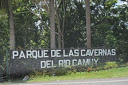
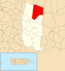
Callejones is a barrio in the municipality of Lares, Puerto Rico. Its population in 2010 was 4,575.[3][4][5] Machos Cave (Spanish: Cueva Machos) and Pajita Cave (Spanish: Cueva Pajita) are located in Callejones.[6]
^ ab"US Gazetteer 2019". US Census. US Government. Archived from the original on 2020-01-16. Retrieved 2020-07-03.
^U.S. Geological Survey Geographic Names Information System: Callejones barrio
^Picó, Rafael; Buitrago de Santiago, Zayda; Berrios, Hector H. (1969). Nueva geografía de Puerto Rico: física, económica, y social, por Rafael Picó. Con la colaboración de Zayda Buitrago de Santiago y Héctor H. Berrios. San Juan Editorial Universitaria, Universidad de Puerto Rico,1969. Archived from the original on 2018-12-26. Retrieved 2019-01-03.
^Gwillim Law (20 May 2015). Administrative Subdivisions of Countries: A Comprehensive World Reference, 1900 through 1998. McFarland. p. 300. ISBN 978-1-4766-0447-3. Retrieved 25 December 2018.
^Puerto Rico: 2010 Population and Housing Unit Counts.pdf(PDF). U.S. Dept. of Commerce, Economics and Statistics Administration, U.S. Census Bureau. 2010. Archived (PDF) from the original on 2017-02-20. Retrieved 2019-01-03.
^"Lares: Ciudad de cielos abiertos". Nueva Isla (in Spanish). SG Communications. Archived from the original on 2019-02-09. Retrieved 2019-03-03.
Machos) and Pajita Cave (Spanish: Cueva Pajita) are located in Callejones. Callejones was in Spain's gazetteers until Puerto Rico was ceded by Spain in...
Callejones Site is an archaeological site consisting of a batey (a large clearing where ceremonies took place) located in Lares, Puerto Rico. It is of...
Turkey, Los Callejones and La Quebrada for a long time were known as one, which was simply named Turkey, the last two being known as Los Callejones de Turkey...
Montserrat, Catalonia Roques de Benet, Ports de Beseit, Catalonia Los Callejones de Las Majadas, Serranía de Cuenca, Castile-La Mancha El Guerrero Romano...
and includes the Alcomún y Partida, San Miguel y Comala and San Gabriel/Callejones peaks. The last is between the Salado and Naranjo or Coahuayana Rivers...
southwestern Mexico, including a peak accumulation of 17.31 in (440 mm) in Callejones, Colima. At least 20 municipalities in Michoacán were affected by flooding...
person being asked for. Ramon Garcia was shot as he got off a bus in Callejones, Santa Barbara. The Secretary of Information, Réne Cepeda, told the AFP...
Name on the Register Image Date listed Location Barrio Description 1 Callejones Site Upload image September 2, 1999 (#99001022) Address restricted Address...
Las Majadas Municipality Los Callejones de Las Majadas rock formations in the Serranía de Cuenca Las Majadas Show map of Spain Las Majadas Show map of...
Tres Angeles Bateyes de Viví Caguana Ceremonial Indigenous Heritage Park Callejones Site Cueva La Espiral Cueva La Mora La Piedra Escrita Heladería de Lares...
located on the coast of Villa de Mazo. The population data are as of 2013: Callejones (pop: 350) Lodero (pop: 470) Lomo Oscuro (pop: 260) Malpaises (Arriba)...
Mestanza itself there are archeological sites in La Tabernera, El Chupón and Callejones de Río Frío, with remains of schematic painting in Puente Mercedes (El...
 Global Information