"CA 46" redirects here. For the congressional district, see California's 46th congressional district.
State Route 46
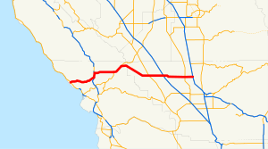
SR 46 highlighted in red
Route information
Maintained by Caltrans
Length
110.696 mi[1] (178.148 km)
SR 46 is broken into pieces, and the length does not reflect the US 101 overlap that would be required to make the route continuous.
History
State highway in 1916; numbered in 1964
Major junctions
West end
SR 1 near Cambria
Major intersections
US 101 in Paso Robles
SR 41 from Shandon to Cholame
I-5 in Lost Hills
SR 43 in Wasco
East end
SR 99 at Famoso
Location
Country
United States
State
California
Counties
San Luis Obispo, Kern
Highway system
State highways in California
Interstate
US
State
Scenic
History
Pre‑1964
Unconstructed
Deleted
Freeways
← SR 45
→ SR 47
State Route 46 (SR 46) is an east–west state highway in the U.S. state of California. It is a major crossing of the Coast Ranges and it is the southernmost crossing of the Diablo Range, connecting SR 1 on the Central Coast near Cambria and US 101 in Paso Robles with SR 99 at Famoso in the San Joaquin Valley.
The road that is now SR 46 was built and improved during the 1920s and was fully paved by 1930. The majority of SR 46 was originally designated as U.S. Route 466; however, after the latter was entirely removed from the U.S. Highway system, the eastern portion of the route became SR 46.
^Cite error: The named reference trucklist was invoked but never defined (see the help page).
and 24 Related for: California State Route 46 information
StateRoute46 (SR 46) is an east–west state highway in the U.S. state of California. It is a major crossing of the Coast Ranges and it is the southernmost...
StateRoute 58 (SR 58) is a major east-west state highway in the U.S. state of California that runs across the Coast Ranges, the southern San Joaquin...
StateRoute 1 (SR 1) is a major north–south state highway that runs along most of the Pacific coastline of the U.S. state of California. At 656 miles...
StateRoute 86 (SR 86) is a north–south state highway in the U.S. State of California that connects the Imperial and Coachella valleys in the southeastern...
StateRoute 41 (SR 41) is a state highway in the U.S. State of California, connecting the Central Coast with the San Joaquin Valley and the Sierra Nevada...
StateRoute 120 (SR 120) is a state highway in the central part of California, connecting the San Joaquin Valley with the Sierra Nevada, Yosemite National...
StateRoute 16 (SR 16) is a state highway in the northern region of the U.S. state of California that runs from Route 20 in Colusa County to Route 49 just...
while the eastern segment is signed as StateRoute 210 (SR 210) to its eastern terminus at I-10. Under the California Streets and Highways Code, the entire...
StateRoute 99 (SR 99) is a north–south state highway in the U.S. state of California, stretching almost the entire length of the Central Valley. From...
StateRoute 138 (SR 138) is an east–west state highway in the U.S. state of California that generally follows the northern foothills of the San Gabriel...
StateRoute 60 (SR 60) is an east–west state highway in the U.S. state of California. It serves the cities and communities on the eastern side of the Los...
state highways in the U.S. state of California that have existed since the 1964 renumbering. It includes routes that were defined by the California State...
StateRoute 57 (SR 57), also known as the Orange Freeway for most of its length, is a north–south state highway in the Greater Los Angeles Area of the...
StateRoute 70 (SR 70) is a state highway in the U.S. state of California, connecting SR 99 north of Sacramento with U.S. Route 395 (US 395) near Beckwourth...
StateRoute 14 (SR 14) is a north–south state highway in the U.S. state of California that connects Los Angeles to the northern Mojave Desert. The southern...
StateRoute 33 (SR 33) is a north–south state highway in the U.S. state of California. It runs north from U.S. Route 101 in Ventura through the Transverse...
StateRoute 160 (SR 160) is a state highway in the U.S. state of California consisting of two sections. The longer, southern, section is a scenic highway...
StateRoute 152 (SR 152) is a state highway that runs from east to west near the middle of the U.S. state of California from StateRoute 1 in Watsonville...
StateRoute 20 (SR 20) is a state highway in the northern-central region of the U.S. state of California, running east–west north of Sacramento from the...
StateRoute 55 (SR 55) is an 18-mile (30-km) long north–south state highway that passes through suburban Orange County in the U.S. state of California...
StateRoute 96 (SR 96) is a state highway in the U.S. state of California that follows the Trinity and Klamath Rivers between StateRoute 299 in Willow...
StateRoute 73 (SR 73) is an approximately 17.76-mile (28.58 km) state highway in Orange County, California. The southernmost 12 miles (19.31 km) of the...
StateRoute 24 (SR 24) is a heavily traveled east–west state highway in the U.S. state of California that serves the eastern side of the San Francisco...
 Global Information