This article includes a list of general references, but it lacks sufficient corresponding inline citations. Please help to improve this article by introducing more precise citations.(December 2012) (Learn how and when to remove this message)
CFS Station Ramore
Coordinates
48°25′37″N080°14′30″W / 48.42694°N 80.24167°W / 48.42694; -80.24167 (Ramore AS C-10)
Type
Radar Station
Code
C-10
Site information
Controlled by
United States Air Force Royal Canadian Air Force
Site history
Built
1953
Built by
United States Air Force
In use
1953-1962,1962-1974
CFS Ramore
class=notpageimage|
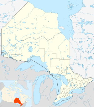
Location of Canadian Forces Station Ramore, Ontario
Station badge
Canadian Forces Station Ramore (ADC ID: C-10) is a closed General Surveillance Radar station. It is located 4 miles (6.4 km) east of Ramore, Ontario. It was closed in 1974. It was operated as part of the Pinetree Line network controlled by NORAD. It has since been sold and is now private property.
Ramore is located close to the site of Mid-Canada Line Site 070 Kempis, which operated a communications relay as part of the Mid-Canada Line. They are situated on either side of Ontario Highway 11, a short distance southwest of the town of Matheson.
CFSRamore Canadian Forces Station Ramore (ADC ID: C-10) is a closed General Surveillance Radar station. It is located 4 miles (6.4 km) east of Ramore...
Canadian Forces Station Debert (also CFS Debert) was a Canadian Forces station located in Debert, Nova Scotia. It was most recently used during the Cold...
Alert (French: Station des Forces canadiennes Alert), often shortened to CFS Alert (SFC Alert), is a signals intelligence intercept facility of the Canadian...
336495; -75.587504 Canadian Forces Station Leitrim, also referred to as CFS Leitrim, is a Canadian Forces Station located in the neighbourhood of Leitrim...
Station Ladner. The downsizing associated with unification would soon hit CFS Ladner, and in 1971 it was permanently closed. Following the closure of the...
formerly known by its military designation, Canadian Forces Station Carp (CFS Carp), is a large underground four-storey reinforced concrete bunker and...
CFS Beausejour Canadian Forces Station Beausejour (ADC ID: C-17) is a closed General Surveillance Radar station. It is located 45.1 miles (72.6 km) east-northeast...
Canadian Forces Station (CFS) Shelburne is a former Canadian Forces Station that was a shore terminus for the Sound Surveillance System (SOSUS) from 1955...
Squadron, RCAF Station Kamloops, became simply Canadian Forces Station (CFS) Kamloops in 1967. A small trailer park called McNair Park was established...
Naval Radio Station Gander, was renamed Canadian Forces Station Gander, or CFS Gander. In 1970 a new expanded communications monitoring facility was constructed...
Canadian Forces Station Sydney, also known as CFS Sydney, is a former Canadian Forces Station located in the community of Lingan Road, Nova Scotia. It...
Training (CFSSAT), as well as the Canadian Forces School of Meteorology (CFS Met). For flight operations support, the base houses the following units:...
CFS Barrington Canadian Forces Station Barrington, also referred to as CFS Barrington, was a Canadian Forces Station located in the unincorporated community...
Canadian Forces Station Foymount (CFS Foymount) was a military radar station in Foymount, Ontario, Canada, (part of Bonnechere Valley). RCAF Station Foymount...
CFS Lowther Canadian Forces Station Lowther (ADC ID: M-119/C-119) is a closed General Surveillance Radar station. It is located 12.7 miles (20.4 km) east-southeast...
G. Diefenbaker – proposed Arctic icebreaker CFS Alert – Canada's other arctic military installation CFS Frobisher Bay - former Canadian arctic military...
Squadron, RCAF Station Beaverlodge, became simply Canadian Forces Station (CFS) Beaverlodge in 1966. Also in 1966, the facilities at Larson AFB were closed...
military-operated radio communications receiver station linked by land line to CFS Carp located in Burnt Lands alvar off Lanark County Road 49 East of Almonte...
 Global Information