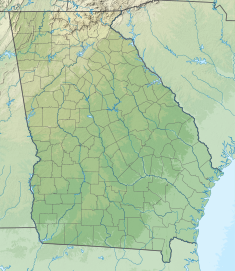
Buford Dam is a dam in Buford, Georgia which is located at the southern end of Lake Lanier,[4] a reservoir formed by the construction of the dam in 1956. The dam itself is managed by the United States Army Corps of Engineers.
The dam is made of earth and concrete,[5] supplemented by three saddle dikes,[1] and was built to provide a water source for the Atlanta area, power homes, and prevent flooding of the Chattahoochee River.[6][7]
Electricity from the dam is marketed by the Southeastern Power Administration.[8]
^ abUnited States. Army. Corps of Engineers (1975). Buford Dam and Lake Sidney Lanier Flood Control, Navigation, Power: Environmental Impact Statement (Report). Archived from the original on September 7, 2022. Retrieved August 19, 2022.
^ abcde"Buford Dam – Chattahoochee River, Georgia – Pertinent Data". janandpat.net. Archived from the original on April 26, 2017. Retrieved August 19, 2022.
^"Hydropower Facilities". United States Army Corps of Engineers. Archived from the original on April 22, 2021. Retrieved August 19, 2022.
^"Buford Dam Park on Lake Lanier". September 23, 2019. Archived from the original on August 18, 2022. Retrieved August 18, 2022.
^Cite error: The named reference cook was invoked but never defined (see the help page).
^Cite error: The named reference kerns was invoked but never defined (see the help page).
^Collier, Michael; Webb, Robert H.; Schmidt, John C. (2000). Dams and Rivers A Primer on the Downstream Effects of Dams. U.S. Geological Survey, Branch of Information Services. p. 39. ISBN 9780788126987. Archived from the original on September 7, 2022. Retrieved August 19, 2022.
^"Generation – Southeastern Power Administration". Energy.gov. Retrieved March 20, 2023.
BufordDam is a dam in Buford, Georgia which is located at the southern end of Lake Lanier, a reservoir formed by the construction of the dam in 1956...
portion of the U.S. state of Georgia. It was created by the completion of BufordDam on the Chattahoochee River in 1956, and is also fed by the waters of the...
10,500 kW). In 1957 it was raised to regulate the flow from the larger BufordDam, 36 miles (58 km) upstream, in order to give Atlanta water during the...
Cornelia (6 miles or 10 km northwest of) near Buford (4 miles or 6 km northwest of) immediately down from BufordDam near Norcross (5 miles or 8 km north of)...
Allatoona Dam, BufordDam, Carters Dam, West Point Dam, Walter F. George Dam, Robert F. Henry Dam, Jim Woodruff Dam, and Millers Ferry Dam Nashville District...
finished in 1930; acquired by the TVA in 1939 BufordDam – Lake Lanier Carters Dam – Carter's Lake Chatuge Dam – Chatuge Reservoir; on the Hiwassee River;...
between BufordDam and Peachtree Creek. Enacted in 1973, the Metropolitan River Protection Act initially covered a 48-mile corridor between BufordDam (on...
attention off the Snowman. During their run, they are pursued by Sheriff Buford T. Justice, of Portague County, Texas. Smokey and the Bandit was a box office...
headwaters for much of metro Atlanta's water supply, held in Lake Lanier by BufordDam. The Oconee River also begins near Athens, and the Little Tennessee River...
Interchange with I-75, I-85 is routed along a 10-lane-wide viaduct from the Buford Highway Connector (exit 86) to SR 400 (exit 87). Continuing northeast of...
islands were originally large hills near Gainesville. After the creation of BufordDam and the flooding of part of the Chattahoochee River valley created Lake...
large bridges were built in this area to accommodate the construction of BufordDam in 1956, which created a reservoir requiring large bridges like this one...
more dangerous. The Chattahoochee rose to the highest levels since the BufordDam was built. Water levels along the river rose over the 0.2 percent chance...
creation of Lake Lanier in the 1950s. This reservoir was formed behind the BufordDam on the Chattahoochee River. (Both counties were organized later after...
between the United States Bureau of Reclamation (USBR), which had built Hoover Dam, and the National Park Service (NPS), which had experience in managing visitors...
starting in the Blue Ridge Mountains in north Georgia and passing through BufordDam in northern Atlanta. The northern portion of the river basin is in the...
which it ended at a point now under the waters of Lake Lanier, since BufordDam was finished in 1956. The northwestern arm of the lake, which flooded...
 Global Information