British Columbia Shore Station Oceanographic Program information
Water temperature and salinity monitoring program
Amphitrite point
Departure Bay
Race Rocks
Nootka
Kains Island
Entrance Island
Langara Point
Pine Island
McInnes Island
Bonilla Island
Chrome Island
Egg Island
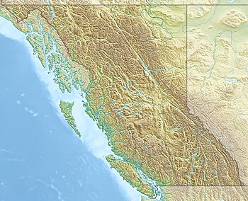
class=notpageimage|
Lightstations part of the British Columbia Shore Station Oceanographic Program.
The British Columbia Shore Station Oceanographic Program is a sea surface temperature and salinity monitoring program on the Canadian coast of the northeast Pacific Ocean.[1] The program is administered by Fisheries and Oceans Canada, and regroups 12 lighthouse stations in British Columbia. Most lighthouses are staffed by the Department of Fisheries and Oceans, but some have independent contractors instead.[2]
The practice of recording ocean water temperature and salinity levels in the area was initiated in 1914 at the Pacific Biological Station in Nanaimo. Data is collected daily around the time of the daytime high tide. The methodology of the sampling was originally designed by oceanographer John P. Tully, and was never modified in order to maintain the homogeneity of the data. The program expanded to 12 stations in the 1930s. Over time, more stations joined the programs while others stopped reporting. Currently, twelve stations remain in the program.[3][4]
Data from the Amphitrite point and Kains island lightstations, which started reporting in the mid-1930s, show an increase in coastal water temperatures of 0.08 °C per decade. On the other hand, data from the Entrance Island station, which started reporting around the same time, show an increase in coastal water temperatures of 0.15°C per decade. These trends are a result of anthropogenic climate change.[5]
The stations currently being monitored as part of the program are:[3]
Lightstation / location
Active since
Amphitrite point lightstation
1934
Bonilla island lightstation
1960
Chrome island lightstation
1961
Departure bay (PBS)
1914
Egg island lightstation
1970
Entrance island lightstation
1936
Kains island lightstation
1935
Langara point lightstation
1936
Mcinnes island lightstation
1954
Nootka point lightstation
1934
Pine island lightstation
1937
Race Rocks Light
1921
^Finnis, Stephen; Krstic, Nikolas; McIntyre, Lorraine; Nelson, Trisalyn A.; Henderson, Sarah B. (2017-07-01). "Spatiotemporal patterns of paralytic shellfish toxins and their relationships with environmental variables in British Columbia, Canada from 2002 to 2012". Environmental Research. 156: 190–200. doi:10.1016/j.envres.2017.03.012. ISSN 0013-9351. PMID 28359039. S2CID 24638887.
^"Data from BC lightstations". www.dfo-mpo.gc.ca. Fisheries and Oceans Canada. 2019-03-21. Archived from the original on 2019-06-19. Retrieved 2021-02-11.
^ ab"British Columbia Lightstation Sea-Surface Temperature and Salinity Data (Pacific), 1914-present - Open Government Portal". open.canada.ca. Treasury Board of Canada. Retrieved 2021-02-11.
^"British Columbia Lightstation Sea-Surface Temperature and Salinity Data (Pacific), 1914-present". zoology.ubc.ca. 2017-03-27. Archived from the original on 2021-02-11. Retrieved 2021-02-11.
^"Canada's Changing Climate Report (CCCR)". 2019. p. 358. Archived from the original on 2019-04-01. Retrieved 2021-02-10. There is only a 1% possibility that the trend is due to chance
and 26 Related for: British Columbia Shore Station Oceanographic Program information
Island Egg Island The BritishColumbiaShoreStationOceanographicProgram is a sea surface temperature and salinity monitoring program on the Canadian coast...
Passage of BritishColumbia. From 1937 to 1955, the Ivory Island lightstation was part of the BritishColumbiaShoreStationOceanographicProgram, collecting...
From 1969 to 1980, the Bamfield Marine Station was part of the BritishColumbiaShoreStationOceanographicProgram, collecting coastal water temperature...
5/km2 (104.9/sq mi) in 2021. From 1942 to 1942, the BritishColumbiaShoreStationOceanographicProgram was collecting coastal water temperature and salinity...
over to the BC government. From 1927 to 1969, the BritishColumbiaShoreStationOceanographicProgram was collecting coastal water temperature and salinity...
1938 to 1942, and then again from 1949 to 1957, the BritishColumbiaShoreStationOceanographicProgram was collecting coastal water temperature and salinity...
Strait. The Pacific Biological Station is one of 12 locations part of the BritishColumbiaShoreStationOceanographicProgram, collecting coastal water temperature...
1971 to 1998, the Cape Beale Light was part of the BritishColumbiaShoreStationOceanographicProgram, collecting coastal water temperature and salinity...
The station has a helicopter landing deck and rescue boat. The light is one of the 12 locations of the BritishColumbiaShoreStationOceanographic Program...
atmosphere. The number of climate change–related events, such as the 2021 BritishColumbia Floods and an increasing number of forest fires, has become an increasing...
Act Collapse of the Atlantic northwest cod fishery BritishColumbiaShoreStationOceanographicProgram Marine Mammal Regulations "Population of the federal...
the "oceanographic" term until 1991 when the mission was declassified. As a result, the commands, Oceanographic System Atlantic and Oceanographic System...
Langara Light is one of 12 lighthouses part of the BritishColumbiaShoreStationOceanographicProgram, collecting coastal water temperature and salinity...
atmosphere, and transmits the data to shore in real or near real-time Float (oceanographic instrument platform) – An oceanographic instrument platform used for...
Surveillance Program (jointly funded by Transport Canada and Fisheries and Oceans Canada), from Halifax, St. John's and Comox, BritishColumbia. All CCG regions...
affected by the physics, chemistry, and geology of the oceanographic system. Biological oceanography mostly focuses on the microorganisms within the ocean;...
propane-powered oceanographicstation in order to measure water flows across the Bering Strait. Northwinds crew continued to help maintain the station until its...
island. Observations and surveying were conducted on the island and oceanographic measurements performed in the sea around it. At Ny Sandefjord, a small...
exception of the British Virgin Islands. The PTWC uses seismic data as its starting point, but then takes into account oceanographic data when calculating...
localized, and narrow current of water that moves directly away from the shore by cutting through the lines of breaking waves, like a river flowing out...
 Global Information