View of the Glass House Mountains from Bribie Island.
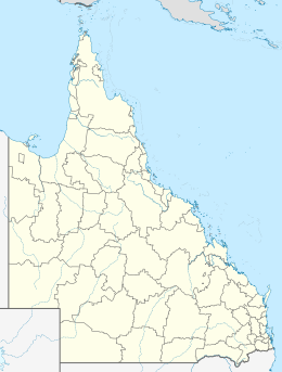
Bribie Island is the smallest and most northerly of three major sand islands forming the coastline sheltering the northern part of Moreton Bay, Queensland, Australia.[1] The others are Moreton Island and North Stradbroke Island. Bribie Island is 34 kilometres (21 miles) long, and 8 kilometres (5.0 miles) at its widest. Archibald Meston believed that the name of the island came from a corruption of a mainland word for it, Boorabee meaning koala.[2] However, the correct Joondaburri name for the island is in fact Yarun.[3]
Bribie Island hugs the coastline and tapers to a long spit at its most northern point near Caloundra, and is separated from the mainland by Pumicestone Passage. The ocean side of the island is somewhat sheltered from prevailing winds by Moreton Island and associated sand banks and has only a small surf break. The lee side is calm, with white sandy beaches in the south.
Most of the island is uninhabited national park (55.8 square kilometres or 21.5 square miles) and forestry plantations. The southern end of the island has been intensively urbanised as part of the City of Moreton Bay, the main suburbs being Bongaree, Woorim, Bellara and Banksia Beach. A bridge from Sandstone Point on the mainland to Bellara and Bongaree was completed in 1963.[4]
Buckley's Hole, at the southern tip of the island, is an important bird habitat and refuge.[4]
On 2 January 2022, the ocean broke through the narrow spit of the island 2 km from the northern tip (due to Cyclone Seth culminating with a king tide). This event created a new passage 200 metres wide.[5] With the ocean waves now able to break onto the mainland at Golden Beach, there is significant concern for the effect this will have for residents and businesses there.[6]
^"Bribie Island (entry 4459)". Queensland Place Names. Queensland Government. Retrieved 20 November 2014.
^Meston, Archibald (20 October 1923). "Old Moreton Bay tribes; their languages". Brisbane Courier (QLD. : 1864 - 1933). Brisbane Courier. p. 18. Archived from the original on 16 March 2018.
^Connors, Libby (2015). Warrior (BorrowBox eBook ed.). Crows Nest, NSW: Allen & Unwin. pp. 17 of 22 in Ch.1, p.10 of 24 in Ch.2, pp.17–18 of 24 in Ch.3. ISBN 9781760110482.
^ ab"Bribie Island – Queensland – Australia: Travel". The Sydney Morning Herald. 8 February 2004. Archived from the original on 7 November 2012. Retrieved 30 October 2010.
^"After years of thinning, the sea has finally carved a passage through Bribie Island thanks to ex-Tropical Cyclone Seth". ABC News. 26 January 2022. Archived from the original on 26 June 2022. Retrieved 26 June 2022.
^"Bribie Island Breakthrough Action Plan". Sunshine Coast Council. 14 June 2022. Archived from the original on 17 July 2022. Retrieved 26 June 2022.
BribieIsland is the smallest and most northerly of three major sand islands forming the coastline sheltering the northern part of Moreton Bay, Queensland...
BribieIsland National Park is an Australian national park in the City of Moreton Bay, Queensland, 68 kilometres (42 miles) north of Brisbane. The park...
coordinates) The BribieIsland Second World War Fortifications are heritage-listed fortifications at Woorim and BribieIsland North on BribieIsland, Queensland...
Island Boyne Island Brampton IslandBribieIsland Brisk Island Brook Islands, three islands: North, Tween and Middle. Bourke Isles Bushy Island Bushy Islet...
network, as well as Moreton Bay (including Moreton, North Stradbroke and Bribieislands, and coastal suburbs such as Shorncliffe, Wynnum and those on the Redcliffe...
duo formed in 2017 consisting of Paddy Macrae and Zane Harris from BribieIsland. They describe their music as "acoustic folk with a little 'singer-song...
Other examples of large sand islands are Moreton, North Stradbroke and BribieIslands which lie south of K’gari off the east coast of Brisbane, Australia...
urbanised areas of BribieIsland, as well as parts of Caboolture. It is named after the Pumicestone Channel, the strait which divides BribieIsland from the mainland...
There are more islands to the south, South Stradbroke Island and North Stradbroke Island, and to the north; BribieIsland and Fraser Island (reputed to be...
per hour (60 mph). The next 22 kilometres (14 mi) to the Caboolture / BribieIsland interchange has six lanes and a maximum speed limit of 100 kilometres...
station, 21 kilometres (13.0 mi) away, and the Caloundra bus station. BribieIsland is located across the Pumicestone Passage to the south. Caloundra marks...
large barrier islands. Running north to south they are BribieIsland, Moreton Island, North Stradbroke Island and South Stradbroke Island (the last two...
narrow, mesotidal waterway around 45 kilometres in length, between BribieIsland and the mainland in Queensland, Australia. The northern extent of the...
Stradbroke and Bribieislands also covered by the Moreton Island National Park, Naree Budjong Djara National Park and the BribieIsland National Park respectively...
2010-05-04 at the Wayback Machine> Gipson, D. “Take Bligh’s promises on BribieIsland desalination plan with grain of salt.” LNP. 19 April 2010. Web. 29 April...
Moreton Bay operates libraries at Albany Creek, Arana Hills, Bongaree (BribieIsland), Burpengary, Caboolture, Deception Bay, North Lakes, Redcliffe, Strathpine...
BribieIsland Seaside Museum opened on 14 May 2010 at 1 South Esplanade, Bongaree, on the Pumicestone Passage side of BribieIsland, City of Moreton Bay...
Moreton Bay' also has a detailed summary of inter-tribal fights in the BribieIsland region, as witnessed by castaways John Finnegan and Thomas Pamphlett...
 Global Information