 Global Information
Breezanddijk information
Breezanddijk
Breesândyk | |
|---|---|
Village | |
 Texaco (now Esso) gas station at Breezanddijk on the Afsluitdijk | |
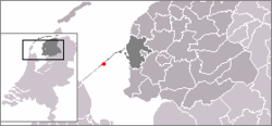 Location in the former Wymbritseradiel municipality | |
 Breezanddijk Location in the Netherlands  Breezanddijk Breezanddijk (Netherlands) | |
| Coordinates: 53°01′12″N 5°12′25″E / 53.02000°N 5.20694°E | |
| Country | |
| Province | |
| Municipality | |
| Area [1] | |
| • Total | 1.63 km2 (0.63 sq mi) |
| Population (2021)[1] | |
| • Total | 5 |
| • Density | 3.1/km2 (7.9/sq mi) |
| Time zone | UTC+1 (CET) |
| • Summer (DST) | UTC+2 (CEST) |
| Postal code | 8766 |
| Dialing code | 0517 |
Breezanddijk (West Frisian: Breesândyk) is a small community that lies near the midpoint of the Afsluitdijk, part of the A7 motorway, in the Netherlands. It is located on a former artificial island which was created during the construction of the dam, and it belongs to the municipality of Súdwest-Fryslân, in Friesland province. The hamlet lies between Den Oever and Kornwerderzand.
- ^ a b "Kerncijfers wijken en buurten 2021". Central Bureau Statistics. Retrieved 26 February 2022.