Boulsworth Hill is a large expanse of moorland, the highest point of the South Pennines of south-eastern Lancashire, England, separating the Borough of Pendle from Calderdale.
Its summit, Lad Law, is 1,696 ft (517 m) above sea level, and commands views over Pendle Hill, the Forest of Bowland, the Yorkshire Dales and the South Pennines.[1] On an exceptionally clear day it is possible to see Scafell Pike and Helvellyn to the north, Ferrybridge power station to the east, High Peak to the south and the Big One roller coaster at Blackpool Pleasure Beach to the west. The Brontë Way and the Pendle Way both pass along the slopes of Boulsworth Hill, providing routes of ascent from Nelson and Wycoller. A further possibility is to climb from Trawden, the nearest town to the summit, and it was originally intended that Boulsworth Hill would be a highlight of the Pennine Way,[2] which instead passes to the east of the hill. Following the CRoW Act, Boulsworth Hill can now also be legally climbed from the Yorkshire side, near Hebden Bridge.[3]
The underlying rock is Millstone Grit, which is seen outcropping in several places[4] and forming a steep scarp face along the summit.[5] The hill is covered by acidic grassland,[6] which provide a valuable breeding ground for red grouse, twite,[5] golden plover[5] and other birds.
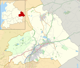
It lies just inside Lancashire, although the county boundary with the West Yorkshire district of Calderdale passes just a mile to the southeast of Lad Law.
^"View Points". Lancashire County Council. Archived from the original on 3 February 2007.
^Nick Redman (19 September 2004). "Cool hikes for UK stile gurus". The Observer.
^Andrew Bibby (2005). Forest of Bowland: With Pendle Hill and the West Pennine Moors. Frances Lincoln Publishers. ISBN 0-7112-2502-8.
^"South Pennine Moors SSSI" (PDF). English Nature.
^ abc"A Landscape Strategy for Lancashire — Landscape Character Assessment" (PDF). Lancashire County Council. 2000. Archived from the original (PDF) on 5 January 2007. (HTML version Archived September 29, 2007, at the Wayback Machine)
^"Grasslands". The Lancashire Wildlife Trust. 2006. Archived from the original on 28 September 2007.
BoulsworthHill is a large expanse of moorland, the highest point of the South Pennines of south-eastern Lancashire, England, separating the Borough of...
Pendle, Lancashire, England. The ward represents the area surrounding BoulsworthHill, including the villages of Trawden, Laneshaw Bridge and Wycoller, and...
One such chain in Britain would read: Billinge Hill → Winter Hill → Hail Storm Hill → BoulsworthHill → Kinder Scout → Cross Fell → Helvellyn → Scafell...
and 38 miles (58, 71 and 61 km), 119 degrees BoulsworthHill, 63 miles (101 km), 135 degrees Pendle Hill, 55 miles (89 km), 138 degrees Ward's Stone,...
slopes of BoulsworthHill, whilst the long distance Bronte Way passes through en route to Haworth. Colne is approximately 5 miles east of Pendle Hill, arguably...
Salterforth Sough Trawden Wheatley Lane Winewall Wycoller BoulsworthHill Noyna Hill Pendle Hill Weets Hill The following people and military units have received...
is a village in the Trawden Forest parish of Pendle, at the foot of BoulsworthHill, in Lancashire, England. The village co-operatively owns and runs its...
called Beardshaw) and the hamlets of Cottontree, Winewall and Wycoller. BoulsworthHill is a well known local landmark situated within the parish. It takes...
enjoys views towards BoulsworthHill to its southeast, the former cotton town of Nelson, about two miles to its south and Pendle Hill to its west across...
This is a list of Marilyn hills and mountains in the United Kingdom, Republic of Ireland and surrounding islands and sea stacks. Marilyns are defined...
Hail Storm Hill, also known as Cowpe Moss, is the highest point of the Rossendale Valley, England, an area of moorland and hill country situated between...
Noyna Hill (sometimes called Noyna or Noyna Rock/s) is a hill in the Pennine range in Pendle, Lancashire, England. It is a mile east of Foulridge and...
Barrowford and Pendleside in 2022. * Elected as a Conservative Councillor for Boulsworth and Foulridge in 2021. * Elected as a Labour Councillor for Bradley in...
Boulsworth and Foulridge Party Candidate Votes % ±% Conservative David Charles Cockburn-Price* 1,123 56.4 -2.7 Labour Wayne Blackburn 464 23.3 +7.9 Liberal...
Reservoir, which is fed by Catlow Brook (from the Coldwell Reservoirs near BoulsworthHill) and its tributaries, the river heads northwest into the town of Nelson...
Boulsworth Party Candidate Votes % ±% Conservative Sarah Cockburn-Price 647 44.1 UKIP Graham Cannon 359 24.5 Labour Robert Oliver 261 17.8 Liberal Democrats...
Boulsworth and Foulridge (1 seat) Party Candidate Votes % ±% Conservative Kevin John Salter 1,227 54.6 -1.6 Labour Wayne Blackburn 457 20.3 +4.9 Liberal...
Boulsworth Party Candidate Votes % ±% Conservative Sarah Cockburn-Price 742 52.1 Liberal Democrats Mary Thomas 315 22.1 Labour Co-op David Foat 205 14...
Boulsworth and Foulridge (3 seats) Party Candidate Votes % ±% Conservative Sarah Cockburn-Price* 1,498 63.4 Conservative David Cockburn-Price 1,362 57...
Alan Davies, in Boulsworth, deputy mayor Marjorie Adams in Coates ward and the chairman of the Nelson committee David Foster in Clover Hill. The only candidates...
Gary Bird from Clover Hill ward, Allan Buck from Coates ward, Sonia Robinson from Southfield ward and Violet Vaughan from Boulsworth ward. After having run...
was 1 independent. 17 seats were contested, with 2 seats available in Boulsworth after Conservative councillor George Askew resigned his seat on the council...
Usual Resident Population Archived 22 April 2015 at the Wayback Machine Boulsworth (part);; Foulridge (part); Horsfield; Vivary Bridge; and Waterside wards...
held 27 seats and had an overall majority of 7. The Conservatives gained Boulsworth from the Liberal Democrats by 7 votes after 3 recounts to have 14 seats...
Boulsworth Party Candidate Votes % ±% Conservative Paul John Foxley 938 60.3 Labour Mark Anthony Attwood 311 20.0 Liberal Democrats Heather Ann Greeves...
 Global Information