6 March 1906 (Shire) 17 June 1961 (Municipality) 9 March 1979 (City)
Area
246.9 km2 (95.3 sq mi)
Time zone
AEST (UTC+10)
• Summer (DST)
AEDT (UTC+11)
Mayor
Brad Bunting
Council seat
Civic Centre, Blacktown
Region
Western Sydney
State electorate(s)
Blacktown
Winston Hills
Mount Druitt, Riverstone
Londonderry, Prospect
Federal division(s)
Chifley
Greenway
McMahon
Website
Blacktown City Council
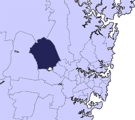
LGAs around Blacktown City Council:
Penrith
Hawkesbury
The Hills Shire
Penrith
Blacktown City Council
Parramatta
Penrith
Fairfield
Cumberland
Blacktown City Council is a local government area in Western Sydney, situated on the Cumberland Plain, approximately 35 kilometres (22 mi) west of the Sydney central business district, in the state of New South Wales, Australia. Established in 1906 as the Blacktown Shire and becoming the Municipality of Blacktown in 1961 before gaining city status in 1979, the City occupies an area of 246.9 square kilometres (95.3 sq mi) and has a population of 410,419, making it the most populous local government area in Sydney.[2]
The acting-mayor of Blacktown City Council is Councillor Chris Quilkey following the death of then-mayor Tony Bleasdale, a member of the Australian Labor Party who died 3 May 2024.[3]
^Australian Bureau of Statistics (28 June 2022). "Blacktown". 2021 Census QuickStats. Retrieved 29 February 2024.
^"City profile – Blacktown City". Archived from the original on 16 December 2017.
^Cite error: The named reference :0 was invoked but never defined (see the help page).
and 18 Related for: Blacktown City Council information
BlacktownCityCouncil is a local government area in Western Sydney, situated on the Cumberland Plain, approximately 35 kilometres (22 mi) west of the...
Blacktown is a suburb in the City of Blacktown local government area, in the state of New South Wales, Australia. Blacktown is located 34 km (21 mi) west...
politician. He served as a Labor councillor on BlacktownCityCouncil from 1996 and Mayor of Blacktown until his death in May 2024. He previously served...
protected area owned by Western Sydney Parklands Trust and operated by BlacktownCityCouncil that opened in 1981. The Nature Reserve is a site of state heritage...
Blacktown Site, Lloydhurst, BNI, Epping Estate, Epping Forest Estate and Native Institution Centre. The property is owned by BlacktownCityCouncil (Local...
Westpoint Blacktown is a large shopping centre situated in Blacktown, Western Sydney, New South Wales, owned by Queensland Investment Corporation. It was...
division in the state of New South Wales. Greenway includes the BlacktownCityCouncil in Sydney's west and northwestern suburbs. Greenway is a relatively...
Blacktown International Sportspark (BISP) (formally known as Blacktown Olympic Park) is a multi-sports venue located in Rooty Hill, a suburb in Sydney...
Druitt, City of Blacktown, New South Wales, Australia. It was built by Charles or James Paull. The property is owned by BlacktownCityCouncil. It was...
". ABC News. 11 May 2018. Retrieved 3 May 2020. "Councillors". BlacktownCityCouncil. Archived from the original on 9 October 2007. Retrieved 25 March...
of Blacktown since a by-election held to replace former Labor leader John Robertson in late 2017. He previously served as the mayor of BlacktownCity Council...
between the local government areas of the City of Parramatta, the City of Blacktown and Cumberland Council. The suburb is often locally referred to as...
located within the BlacktownCity local government area, but is also close to the boundaries of Cumberland Council (to the east) and the City of Fairfield (to...
details Transport for New South Wales BlacktownCityCouncil – Photo of the original railway station BlacktownCityCouncil – Photo of the ceremony at commencement...
the BlacktownCityCouncil, Blue Mountains CityCouncil, City of Canterbury-Bankstown, Cumberland Council, Fairfield CityCouncil, Hawkesbury City Council...
Sydney central business district, in the local government area of the City of Blacktown, and is part of the Greater Western Sydney region. There are numerous...
their mark. Blacktown, NSW. Nicolaidis, G. (1990). The Druitts of Mount Druitt. BlacktownCityCouncil: Blacktown, NSW. BlacktownCityCouncil Library Service...
 Global Information