 Global Information
Biryulyovo Vostochnoye District information
Biryulyovo Vostochnoye District
Район Бирюлёво Восточное | |
|---|---|
District | |
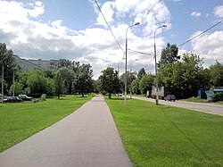 Elevatornaya Street, Biryulyovo Vostochnoye District | |
 Flag  Coat of arms | |
 Location of Biryulyovo Vostochnoye District in the federal city of Moscow (pre-2012 map) | |
| Coordinates: 55°35′N 37°40′E / 55.583°N 37.667°E | |
| Country | Russia |
| Federal subject | Federal city of Moscow[1] |
| Established | July 5, 1995 |
| Area [2] | |
| • Total | 14.772 km2 (5.704 sq mi) |
| Population (2010 Census)[3] | |
| • Total | 145,100 |
| • Estimate (2018)[4] | 154,191 (+6.3%) |
| • Density | 9,800/km2 (25,000/sq mi) |
| Municipal structure | |
| • Municipally incorporated as | Biryulyovo Vostochnoye Municipal Okrug[5] |
| Time zone | UTC+3 (MSK |
| OKTMO ID | 45911000 |
| Website | http://bv.mos.ru |
| 2010 Census | 145,100[3] |
|---|---|
| 2002 Census | 129,700[7] |
Biryulyovo Vostochnoye District (Russian: район Бирюлёво Восточное) is a territorial division (a district, or raion) in Southern Administrative Okrug, one of the 125 in the federal city of Moscow, Russia.[1] It is located in the south of the city and borders with Biryulyovo Zapadnoye in the west, Tsaritsyno in the north, Orekhovo-Borisovo (Severnoye and Yuzhnoye) in the east, and Moscow Ring Road (MKAD) in the south. The area of the district is 14.772 square kilometers (5.704 sq mi).[2] As of the 2010 Census, the total population of the district was 145,100.[3]
- ^ a b Law #13-47
- ^ a b City of Moscow Territorial Branch of the Federal State Statistics Service Показатели, характеризующие состояние экономики и социальной сферы муниципального образования за 2013 год. Бирюлёво Восточное. (in Russian)
- ^ a b c Russian Federal State Statistics Service (2011). Всероссийская перепись населения 2010 года. Том 1 [2010 All-Russian Population Census, vol. 1]. Всероссийская перепись населения 2010 года [2010 All-Russia Population Census] (in Russian). Federal State Statistics Service.
- ^ "26. Численность постоянного населения Российской Федерации по муниципальным образованиям на 1 января 2018 года". Federal State Statistics Service. Retrieved January 23, 2019.
- ^ Cite error: The named reference
FCMoscow_munwas invoked but never defined (see the help page). - ^ "Об исчислении времени". Официальный интернет-портал правовой информации (in Russian). June 3, 2011. Retrieved January 19, 2019.
- ^ Federal State Statistics Service (May 21, 2004). Численность населения России, субъектов Российской Федерации в составе федеральных округов, районов, городских поселений, сельских населённых пунктов – районных центров и сельских населённых пунктов с населением 3 тысячи и более человек [Population of Russia, Its Federal Districts, Federal Subjects, Districts, Urban Localities, Rural Localities—Administrative Centers, and Rural Localities with Population of Over 3,000] (XLS). Всероссийская перепись населения 2002 года [All-Russia Population Census of 2002] (in Russian).