 Global Information
Binlang Islet information
24°26′12″N 118°11′56″E / 24.43667°N 118.19889°E
Native name: 檳榔嶼 | |
|---|---|
 Binlang Islet | |
 | |
| Geography | |
| Location | west of Lesser Kinmen/Lieyu in Lieyu Township, Kinmen County (Quemoy), Taiwan (ROC) |
| Administration | |
Republic of China (Taiwan) | |
| County | Kinmen (Quemoy) |
| Rural township | Lieyu |
| Additional information | |
| Time zone |
|
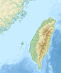
Binlang Islet
class=notpageimage|
Location of Binlang IsletYou can help expand this article with text translated from the corresponding article in Chinese. (August 2019) Click [show] for important translation instructions.
|
Binlang Islet (Chinese: 檳榔嶼[4][5][6]; pinyin: bīn láng yǔ[1][2][3]; Pe̍h-ōe-jī: pin-nn̂g-sū; lit. 'areca nut islet') is an islet located in Lieyu Township, Kinmen County (Quemoy), Taiwan (ROC).[1][2][4][5][7][8][9][10] The islet can be seen from the shore near Lingshui Lake and from the shore near Shaxi Fort (沙溪堡) in the southwestern part of Lesser Kinmen (Lieyu)[11] as well as from Siming District, Xiamen (Amoy), Fujian, China (PRC).[12][13] The highest point on the islet is 47 m (154 ft) above sea level.[1]
- ^ a b c 金門縣行政區域圖 [Kinmen County] (Map) (in Chinese (Taiwan) and English). Ministry of the Interior and Kinmen County Government. September 2007. ISBN 978-986010742-5.
[map]
▲ 檳榔嶼
47 Mt. Binlangyu
{...}
[reverse]
Kinmen County English Classified Index 金門縣英文分類引所
[third column from left]
Name(名稱) Chinese(中文) Index(索引)
{...}
Mt. Binlangyu 檳榔嶼 A7
(Note: The County/City Boundary (縣(市)界) as shown in this map includes Mt. Binlangyu within Kinmen County and the Township/City/District Boundary (鄉(鎮.市.區)界) includes Mt. Binlangyu within Lieyu Township.) - ^ a b Binlang Yu (Approved - N) at GEOnet Names Server, United States National Geospatial-Intelligence Agency
- ^ 教育部重編國語辭典修訂本 (in Chinese (Taiwan)). Retrieved 25 August 2019.
注音 ㄅㄧㄣ ㄌㄤˊ ㄩˇ 漢語拼音 bīn láng yǔ
(Note: same as Penang Island (Pinang), Malaysia) - ^ a b 金門地區限制(禁止)水域圖 [Kinmen Area Restricted (Prohibited) Waters Map] (PDF) (Map) (in Chinese (Taiwan)). Mainland Affairs Council. n.d. Retrieved 3 August 2019.
禁止水域範圍:{...}小金門西海面、檳榔嶼、三腳礁、牛心礁、赤角礁一線以內海域
- ^ a b 金門地區離島通航航道公告圖 (PDF) (Map). Coast Guard Administration (Taiwan) (in Chinese (Taiwan)). n.d. Retrieved 25 August 2019.
檳榔嶼
- ^ Lin Ma-Teng 林馬騰 (July 2009). 秘島:大二膽的秘境秘史 (in Chinese (Taiwan)). 林馬騰文史工作室. p. 36. ISBN 978-957-41-6438-7.
檳榔嶼
- ^ Hsu Chia-Tai 許加泰 (13 July 2014). 金廈泳渡全球華人接力賽 今鳴槍下水. Kinmen Daily News (in Chinese (Taiwan)). Retrieved 26 August 2019.
今年適逢建縣百年,繼「第十二屆金門海上長泳」搶灘料羅灣活動,緊接著「第六屆金廈海域泳渡-全球華人接力公開賽」,也將於今(十三)日接力登場,今日中午12時20分從金門烈嶼鄉雙口海邊鳴槍下水,180菁英泳士游向大陸福建省廈門市椰風寨救生指揮中心海灘,中途在烈嶼鄉檳榔嶼海上平台交接,全長距離是7000公尺,泳士們挑戰新紀錄。
- ^ Chen Pei-Chi 陳沛婍 (21 February 2019). 誰說只有閩式建築可以拍?金門10大超夯打卡景點大特搜. 新頭殼 (in Chinese (Taiwan)). Retrieved 4 August 2019.
金門的行政區域有大金門、烈嶼鄉、大膽島、檳榔嶼及烏坵等,也因其特殊的戰略位置,有著台灣最前線之稱,故島上有著豐富的戰地景觀,像是碉堡、坑道、戰車、軍營等,都是大家來金門觀光時,不能錯過的景點。{...}10、沙溪堡(金門縣烈嶼鄉青岐村附近) 位於金門離島烈嶼鄉的沙溪堡位置特殊,可眺望大膽、二膽、檳榔嶼及廈門,因此在軍事上更肩負重要責任,故在早期時,是十分重要的軍事據點,而現今隨著駐軍的裁撤,經過政府特別的規劃後,沙溪堡也成為來到小金門時,必訪的觀光景點。
- ^ Wang Xiaoyi 王晓易, ed. (26 January 2015). 厦门周边17个无人岛大全!收起来总会用得上(组图). 网易新闻 (NetEase News) (in Simplified Chinese). Archived from the original on 30 July 2017.
台海网{...}槟榔屿{...}目前属于台湾当局控制。
- ^ 臺灣歷史地圖 增訂版 [Taiwan Historical Maps, Expanded and Revised Edition] (in Chinese (Taiwan)). Taipei: National Museum of Taiwan History. February 2018. pp. 39, 154, 158, 161, 168, 169, 170, 172, 173, 174, 177, 180, 183. ISBN 978-986-05-5274-4. (On pages 39 and 158, the islet is inside the maritime boundary of Kinmen (Quemoy) County (shown by a dashed line), excluding the Dadeng Islands (Tateng Islands). On pages 154 and 158, the islet is colored light green as is the rest of Kinmen County, excluding the Dadeng Islands. The islet is found in several other maps of Kinmen County (excluding the Dadeng Islands) included in the book.)
- ^ 景點介紹. 金門縣烈嶼鄉公所 Lieyu Township Village Administration, Kinmen County (in Chinese (Taiwan)). 5 September 2019. Retrieved 5 September 2019.
陵水湖{...}此外,還可眺望檳榔嶼、鼓浪嶼、白石砲等。{...}沙溪堡{...}由於沙溪據點位置特殊,可眺望大膽、二膽、檳榔嶼及廈門本島,
- ^ 环岛路观光大道. 厦门市思明区人民政府 (in Simplified Chinese). 12 July 2015. Archived from the original on 20 August 2019. Retrieved 20 August 2019.
在环岛路上远望,海岸线曲折起伏,海景宜人,大担、二担、槟榔屿、小金门等岛屿一览无余,大金门也隐约可现。
- ^ "Route 3: Urban Development Tour(closed)". 2017 BRICS Summit. 25 August 2017. Archived from the original on 25 August 2019. Retrieved 25 August 2019.
A number of outlying islets, including Lesser Kinmen, Dadan, Er'dan [sic] and Binglang, dot the seawaters off the road.