Website U.S. Army Corps of Engineers - Big Bend Dam / Lake Sharpe
Lake Sharpe with visible Big Bend Dam from space, August 1989. View is to the east-southeast.
Big Bend Dam is a major embankment rolled-earth dam on the Missouri River in Central South Dakota, United States, creating Lake Sharpe. The dam was constructed by the U.S. Army Corps of Engineers as part of the Pick-Sloan Plan for Missouri watershed development authorized by the Flood Control Act of 1944. Construction began in 1959 and the embankment was completed in July 1963. Power generation began at the facility in 1964 and the entire complex was completed in 1966 at a total cost of $107 million. The hydroelectric plant generates 493,300 kilowatts of electricity at maximum capacity, with an annual production of 969 million kilowatt hours,[1] and meets peak-hour demand for power within the Missouri River Basin.
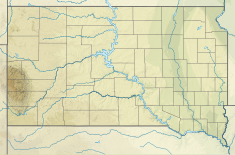
Located near Fort Thompson, South Dakota, just south of the Big Bend of the Missouri River, a large meander, Big Bend Dam creates Lake Sharpe, named after South Dakota Governor Merrill Q. Sharpe. The lake extends for 80 miles (130 km) up the course of the Missouri River passing through Pierre, the State Capitol, to Oahe Dam, another major power-generating and flood control dam. Lake Sharpe covers a total of 56,884 acres (23,020 ha) and drains an area just under 250,000 square miles (650,000 km2).
South Dakota Highway 47 crosses over the dam, connecting Lyman and Buffalo Counties. Big Bend Dam is located approximately 17 miles (27 km) north of I-90, and approximately 60 miles (97 km) southeast of Pierre.
The next dam upstream is Oahe Dam, near Pierre, and the next dam downstream is Fort Randall Dam, near Pickstown.
^"Summary of Engineering Data – Missouri River Main Stem System" (PDF). Missouri River Division. U.S. Army Corps of Engineers. August 2010. Archived from the original (PDF) on 2012-02-07. Retrieved 2012-08-17.
BigBendDam is a major embankment rolled-earth dam on the Missouri River in Central South Dakota, United States, creating Lake Sharpe. The dam was constructed...
Columbia BigBend Country BigBend Ranges, the mountain ranges surrounded by the BigBendBigBend (Florida), part of the Florida Panhandle BigBend Coast...
Lake Sharpe is a large reservoir impounded by BigBendDam on the Missouri River in central South Dakota, United States. The lake has an area of 56,884...
next dam downstream is BigBendDam, near Fort Thompson, South Dakota. South Dakota Highway 204 runs directly atop the Oahe Dam, providing an automobile...
describing portfolio returns Lake Sharpe, created by the construction of BigBendDam in South Dakota Sharpe Field, a private airport in Alabama, United States...
Garrison Dam (near Riverdale, North Dakota), Oahe Dam (near Pierre, South Dakota), BigBendDam (near Fort Thompson, South Dakota), Fort Randall Dam (near...
is Fort Peck Dam (near Fort Peck, Montana). The dams downstream of Garrison Dam are: Oahe Dam (near Pierre, South Dakota), BigBendDam (near Fort Thompson...
upstream to BigBendDam. The reservoir is named for former United States Senator Francis Higbee Case, of South Dakota. The Fort Randall Dam and concomitant...
it. Angostura Dam, Angostura Reservoir, United States Bureau of Reclamation Belle Fourche Dam, Belle Fourche Reservoir, USBR BigBendDam, Lake Sharpe...
two dam projects: 7,997 acres of Indian land for the Fort Randall Dam project and 14,299 acres for the BigBendDam project. In 1963, the BigBendDam on...
Missouri River mainstem dams, the next dam upstream is BigBendDam, near Ft. Thompson and the next dam downstream is Gavins Point Dam, near Yankton. The eight...
BigBend of the Colorado State Recreation Area is a 2,100-acre (850 ha) public recreation area on the west bank of the Colorado River in the Lower Colorado...
from the original (PDF) on May 13, 2012. Retrieved January 17, 2012. "BigBendDam/Lake Sharpe". Omaha District. U.S. Army Corps of Engineers. Archived...
Projects he oversaw included the Garrison Dam, Gavins Point Dam, Tuttle Creek Lake and the BigBendDam. He retired from the Army in 1960 with the rank...
would be $13.2 million for that community. On June 30, the spillway at BigBendDam was temporarily closed for inspections. On June 10, the WinnaVegas Casino...
The BigBend Highway is a 305-kilometre (190 mi) former highway in the interior of British Columbia, and was the original alignment of Highway 1 (Hwy 1)...
as part of surveys and salvage excavations preceding construction of BigBendDam on the Missouri within the reservation boundaries. They discovered human...
McGee BendDam and Reservoir until 1963. In September of that year, the 88th Congress adopted a special resolution changing the name to "Sam Rayburn Dam and...
Dakota. These dams are Gavins Point Dam near Yankton, the Fort Randall Dam near Pickstown, the BigBendDam near Fort Thompson, and the Oahe Dam near Pierre...
part of a salvage archaeology operation preceding the creation of the BigBendDam, which would flood the vicinity under Lake Sharpe. Although the site...
BigBend Historical Area is a national historic district located at Jefferson Township, Mercer County, Pennsylvania. The district includes 4 contributing...
 Global Information