At least 32,000 acres 50 square miles 129 square kilometres 12,950 hectares
Land use
Wildland–urban interface
Impacts
Deaths
2 people
Non-fatal injuries
12 people
Evacuated
5,000 people
Structures destroyed
1,696 (most in Texas history)
Damage
$325 million (2011 USD) (insured losses; costliest in Texas history)
Ignition
Cause
Sparks created following contact between wind-snapped trees and power lines
Map
Perimeter of Bastrop County Complex Fire (map data)
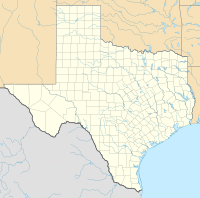
The fire's location in Texas
The Bastrop County Complex fire was a conflagration that engulfed parts of Bastrop County, Texas, in September and October 2011. The wildfire was the costliest and most destructive wildfire in Texas history and among the costliest in U.S. history, destroying 1,696 structures and causing an estimated $350 million in insured property damage. An exceptional drought, accompanied by record-high temperatures, affected Texas for much of 2011. Vegetation consequently became severely parched throughout the state, and over the year an unprecedented amount of land in the state was burned by numerous wildfires. In early September 2011, the presence of Tropical Storm Lee to the east produced strong northerly winds over the state, exacerbating the preexisting dry weather to produce critical fire conditions. On the afternoon of September 4, 2011, three separate fires ignited in the wildland–urban interface east of Bastrop, Texas, after strong winds caused by the nearby tropical storm snapped trees onto power lines. Within 48 hours, the fires merged into one blaze that quickly consumed parts of Bastrop State Park and parts of the Lost Pines Forest, as well as homes in nearby subdivisions. Most of the conflagration's spread and destruction occurred within a week of ignition, as the forward advance of the wildfire mostly stopped after September 7. The wildfire was largely contained in September, though the firebreak was briefly breached in early October. On October 10, the Bastrop County Complex was declared controlled, and the fire was declared extinguished on October 29 after 55 days of burning within the fire perimeter.
Two people were killed by the wildfire, and another twelve people were injured. The fire perimeter encircled an area spanning at least 32,000 acres (12,950 hectares). Homes were destroyed in ten subdivisions, of which Circle-D County Acres and Tahitian Village sustained the most significant property damage. The wildfire destroyed more homes than any single fire in Texas history by nearly a factor of ten. Around 96 percent of Bastrop State Park was scorched by the wildfire. Roughly 1.5 million trees across 16,200 acres (6,600 hectares) of forest were either killed directly by the fire or fatally damaged. Despite the severe habitat loss, populations of local herpetofauna were not significantly affected by the fire, though extensive soil erosion was enabled by the loss of groundcover.
^"Bastrop Fire". InciWeb. National Wildfire Coordinating Group. October 15, 2011. Archived from the original on October 15, 2011. Retrieved January 6, 2023.
and 17 Related for: Bastrop County Complex Fire information
Either Way (Á annan veg). The film was shot in Bastrop, Texas, after the BastropCountyComplexFire. In 1988, an odd pair of sorts, meditative and stern...
the United States during 2024 2024 Texas wildfires BastropCountyComplexFire "Smokehouse Creek Fire Information". InciWeb. InciWeb. March 16, 2024. Retrieved...
The BastropCounty Courthouse is a historic courthouse built in 1883 at 803 Pine St, Bastrop, Texas. The Renaissance Revival style building was designed...
Bastrop State Park is a state park in BastropCounty, Texas, United States. The park was established in 1933 and consists of stands of loblolly pines mixed...
uttarakhand forest fire 1997 Indonesian forest fires 1989 Mount Carmel forest fire 1995 Jerusalem forest fire 2010 Mount Carmel forest fire – Started on 2...
in BastropCounty. In September 2011, the BastropCountyComplexfire devastated a large part of the Houston toad's habitat. The majority of Bastrop State...
on May 6, 2023. Retrieved May 6, 2023. Johnson, Maddy (May 5, 2023). "Bastrop shooting leaves 2 juveniles dead, 2 injured". KNOE. Archived from the original...
2023, the company moved their headquarters and engineering facilities to Bastrop, Texas, approximately 25 miles (40 km) east of Texas Gigafactory. Currently...
Identify Fire Island John Doe". DNASolves.com. Retrieved 2021-12-04. "Winnebago County Sheriff's Office Teams with Othram to Identify 2015 Winnebago County John...
Waterloo District Lost Pines Scout Reservation - BastropCounty, Texas Griffith League Scout Ranch - BastropCounty, Texas Camp Alma McHenry - near Giddings,...
Jersey are listed here County courthouses in New Jersey are listed here For state courthouse see Richard J. Hughes Justice Complex. Federal courthouses...
 Global Information