Global Information Lookup Global Information

Auckland isthmus information


Auckland isthmus
Waitemata Group
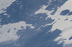
The Auckland isthmus seen from the International Space Station in 2019
Auckland isthmus is located in New Zealand
Auckland isthmus
Location in the Auckland Region
Coordinates: 36°53′50″S 174°46′50″E / 36.89722°S 174.78056°E / -36.89722; 174.78056
LocationAuckland Region, New Zealand
AgeEarly Miocene, Quaternary
Map
Approximate extent of the isthmus, bounded by Portage Road, Ōtāhuhu and Portage Road, New Lynn

The Auckland isthmus, also known as the Tāmaki isthmus,[1] is a narrow stretch of land on the North Island of New Zealand in the Auckland Region, and the location of the central suburbs of the city of Auckland, including the CBD. The isthmus is located between two rias (drowned river valleys): the Waitematā Harbour to the north, which opens to the Hauraki Gulf / Tīkapa Moana and Pacific Ocean, and the Manukau Harbour to the south, which opens to the Tasman Sea. The isthmus is the most southern section of the Northland Peninsula.

The Auckland isthmus is bound on the eastern side by the Tāmaki River and by the Whau River on the west; two tidal estuaries of the Waitematā Harbour.[2] These were used as portages by early Māori migration canoes and Tāmaki Māori to cross the isthmus (the Tāmaki River crossing known as Te Tō Waka, and the Whau River as Te Tōangawaka). Through early European settler history, canals were variously considered at either portage, however by the 1910s these projects were abandoned.

The isthmus was the centre of the Waiohua confederation of iwi in the 17th and early 18th centuries, who centred life around elaborate fortified pā of Maungawhau / Mount Eden and Maungakiekie / One Tree Hill. After the defeat of paramount chief Kiwi Tāmaki circa 1740, the isthmus became the rohe of Ngāti Whātua Ōrākei. In 1840, European settlers established the town of Auckland on the Waitematā Harbour, followed shortly after by the fencible towns of Onehunga, Ōtāhuhu and Panmure. The city developed outwards from the Port of Auckland, and by the mid-20th century the isthmus was almost completely urbanised. Originally organised as a variety of fractured land boards, boroughs and cities, the entire isthmus was amalgamated into a single local authority called Auckland City during the 1989 New Zealand local government reforms, which lasted until the 2010 unification of all local government in the Auckland Region to create the Auckland Council.

Since European colonisation of the region, the isthmus has seen major changes in landscape and infrastructure, including quarrying of scoria cones in the Auckland volcanic field, the draining of swamps and wetlands for farmland and housing and land reclamation on the Auckland waterfront. Large-scale infrastructure projects, including the rail network in the 1870s, the Auckland Motorways from the 1950s, and bridges (most notably the Auckland Harbour Bridge, opening in 1959 and connecting the isthmus to the North Shore), have fuelled population growth and suburban sprawl, both on the isthmus and in the greater Auckland Region.

  1. ^ Cite error: The named reference AileenFox was invoked but never defined (see the help page).
  2. ^ Brown, HJR (1960). "The Tamaki Isthmus". New Zealand Archaeological Association Newsletter. 3 (2): 21–22. Retrieved 8 November 2021.

and 16 Related for: Auckland isthmus information

Request time (Page generated in 1.2326 seconds.)

Auckland isthmus

Last Update:

The Auckland isthmus, also known as the Tāmaki isthmus, is a narrow stretch of land on the North Island of New Zealand in the Auckland Region, and the...

Word Count : 7048

Auckland

Last Update:

Pacific Ocean. Auckland is one of the few cities in the world to have a harbour on each of two separate major bodies of water. The Auckland isthmus was first...

Word Count : 14005

Isthmus

Last Update:

Catanzaro in Italy The cities of Auckland, Manila, and Seattle are located on isthmuses. Canals are often built across isthmuses, where they may be a particularly...

Word Count : 410

Auckland City

Last Update:

Auckland City (Māori: Tāmaki-Makaurau) was a territorial authority with city status covering the central isthmus of the urban area of Auckland, New Zealand...

Word Count : 1487

Northland Peninsula

Last Update:

by the Auckland isthmus, a narrow piece of land between the Waitematā Harbour and the Manukau Harbour in the middle of the Auckland metropolitan area...

Word Count : 600

List of isthmuses

Last Update:

list of isthmuses is an appendix to the article isthmus. The list is sorted by the region of the world in which the isthmus is located. An isthmus ( /ˈɪsθməs/...

Word Count : 945

South Auckland

Last Update:

Auckland, the largest city in New Zealand. The area is south of the Auckland isthmus, and on the eastern shores of the Manukau Harbour. The area has been...

Word Count : 7851

Auckland Region

Last Update:

stretches of the Northland Peninsula, through the Waitākere Ranges and the Auckland isthmus and across the low-lying land surrounding the Manukau Harbour, ending...

Word Count : 932

Auckland volcanic field

Last Update:

The field has produced voluminous lava flows that cover much of the Auckland isthmus. One of the longest runs from Mt Saint John northward, almost crossing...

Word Count : 3395

Dominion Road

Last Update:

Dominion Road is an arterial road in Auckland, New Zealand, running north–south across most of the Auckland isthmus. It is a major public transport route...

Word Count : 1412

Te Waiohua

Last Update:

(tribal area) was primarily the central Tāmaki Makaurau area (the Auckland isthmus) and the Māngere peninsula, until the 1740s when the paramount chief...

Word Count : 1121

Auckland District Health Board

Last Update:

provided healthcare in the Auckland Region in New Zealand, mainly on the Auckland isthmus. This district health board existed between 2001 and 2022 and was governed...

Word Count : 2347

Manukau Harbour

Last Update:

harbour in New Zealand by area. It is located to the southwest of the Auckland isthmus, and opens out into the Tasman Sea. The harbour mouth is between the...

Word Count : 1564

Mount Eden

Last Update:

a dormant volcano whose summit is the highest natural point on the Auckland isthmus. In pre-European times Mount Eden was utilised as a fortified hill...

Word Count : 4043

History of Auckland

Last Update:

commercially dominating metropolis of the country. Māori people settled the Auckland isthmus around 1350, calling it Tāmaki or Tāmaki Makaurau, meaning "Tāmaki...

Word Count : 4078

Onehunga

Last Update:

two bridges, is the suburb of Māngere Bridge. Onehunga lies on the Auckland isthmus, on the northern shore of Mangere Inlet, an arm of the Manukau Harbour...

Word Count : 4526

PDF Search Engine © AllGlobal.net