Global Information Lookup Global Information

Ardullie information


Ardullie
  • Scottish Gaelic: Àird Ilidh
Ardullie is located in Highland
Ardullie
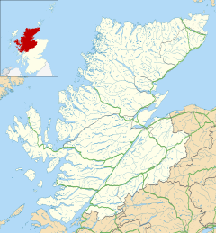
Ardullie
Location within the Highland council area
OS grid referenceNH719662
Council area
  • Highland
CountryScotland
Sovereign stateUnited Kingdom
Postcode districtIV7 8
PoliceScotland
FireScottish
AmbulanceScottish
UK Parliament
  • Ross, Skye and Lochaber
Scottish Parliament
  • Skye, Lochaber and Badenoch
List of places
UK
Scotland
57°38′13″N 4°21′54″W / 57.6369°N 4.365°W / 57.6369; -4.365

Ardullie (Scottish Gaelic: Àird Ilidh) is a village in Ross-shire,[1] in the Highland council area of Scotland. It is on the north shore of the Cromarty Firth, about 5 km north east of Dingwall, and 4 km south west of Evanton.

The name comes from the Gaelic, Àird Ilidh, which means "headland of the Ilidh".[2]

View towards Ardullie point, and the bridge

The Cromarty Bridge - carrying the A9 road - crosses the firth at Ardullie point. There is a roundabout at the point, where the A862 road branches off to Dingwall and Beauly. The railway also passes by Ardullie, with the Far North Line running along the northern side of the firth. There was a station nearby at Foulis, but it has been closed since 1960.

Ardullie Lodge

Also at Ardullie point is Ardullie Lodge, a historic house built in the 17th century.[3] There is a seal colony resident on the shore nearby.[4]

  1. ^ Microsoft; Nokia. "Ardullie" (Map). Bing Maps. Microsoft. Retrieved 23 March 2017.
  2. ^ Iain Mac an Tàilleir (2003). "Placenames collected by Iain Mac an Tailleir". Scottish Parliament. Archived from the original on 25 December 2010. Retrieved 22 January 2011.
  3. ^ Am Baile
  4. ^ "Dingwall - Wildlife". Archived from the original on 2 August 2012. Retrieved 27 January 2011.

and 8 Related for: Ardullie information

Request time (Page generated in 0.5355 seconds.)

Ardullie

Last Update:

Ardullie (Scottish Gaelic: Àird Ilidh) is a village in Ross-shire, in the Highland council area of Scotland. It is on the north shore of the Cromarty Firth...

Word Count : 207

A roads in Zone 8 of the Great Britain numbering scheme

Last Update:

kilometres), this road covers 70 miles (110 kilometres) A862 Inverness Ardullie Previously allocated to a road from Inverness to Fort Augustus (now B862);...

Word Count : 51

Cromarty Bridge

Last Update:

south in Ross and Cromarty with a junction with the A862 to the north at Ardullie Point. It can clearly be seen from the north from the Far North Line. The...

Word Count : 163

Clan Munro

Last Update:

Culcraggie Munro of Ferrytown of Obsdale Munro of Milntown of Katewell Munro of Ardullie Munro of Teanoird Munro of Tain Munro of Milntown of Alness Munro of Teaninich...

Word Count : 5689

Cromarty Firth

Last Update:

Culbokie are nearby. There is one bridge, the A9 road crossing between Ardullie and Findon. In the past there were several ferries across the firth (for...

Word Count : 761

Foulis railway station

Last Update:

Foulis railway station served the village of Ardullie, Highland, Scotland from 1863 to 1964 on the Inverness and Ross-shire Railway. The station opened...

Word Count : 134

Munro of Kiltearn

Last Update:

1884. Hugh Munro, 1st of Ferrytown of Obsdale. Alexander Munro, 1st of Ardullie. John Munro, 2nd of Kiltearn, who succeeded his father in the Kiltearn...

Word Count : 1092

List of listed buildings in Kiltearn

Last Update:

Category B 7913 Upload Photo Ardullie Lodge 57°37′43″N 4°22′09″W / 57.628648°N 4.369214°W / 57.628648; -4.369214 (Ardullie Lodge) Category B 7903 Upload...

Word Count : 295

PDF Search Engine © AllGlobal.net