Plan of Ambleside fort, published in 1915. I. Granaries; II. Headquarters; III. Commandant's House; A. Cellar; B. Hearth or Kiln; C. Deposit of corn; D. Ditch perhaps belonging to earliest fort; E. Outer Court of Headquarters; F. Inner Court
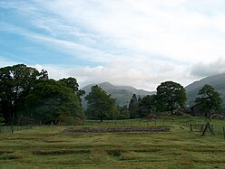
Ambleside Roman Fort is the modern name given to the remains of a fort of the Roman province of Britannia. The ruins have been tentatively identified as those of either Galava or Clanoventa, mentioned in the Antonine Itinerary.[1] Dating to the 1st or 2nd century AD,[2] its ruins are located on the northern shore of Windermere at Waterhead, near Ambleside,[3] in the English county of Cumbria,[4] within the boundaries of the Lake District National Park.[3]
The fort guarded the Roman road from Brougham to the Roman fort of Glannoventa by the sea at Ravenglass, by way of Hardknott Roman Fort. There is also assumed to have been a road south to the fort at Kendal. In 2016 it was reported that LIDAR technology had revealed a Roman road running north from Ambleside fort to Carlisle, and another running northwest to Papcastle.[5] These roads had been previously described by John Horsley in his Britannia Romana of 1732.
The ruins are a Grade I listed structure.[6] The site is open to the public, and is owned and managed by the National Trust.[7] The site is a scheduled monument with list entry numbers of 1009348 and 1244785 (formerly RSM 13567 and RBS 450573)[6][8]
^Smith 1997, pp. 372, 374, 378.
^English Heritage 2004.
^ abOrdnance Survey 2011.
^English Heritage undated 1.
^"Lasers reveal 'lost' Roman roads". GOV.UK. Environment Agency and Department for Environment, Food & Rural Affairs. 3 February 2016. Archived from the original on 3 February 2016. Retrieved 19 January 2022.
^ abHistoric England, "Ambleside Roman fort, associated vicus and Roman road (1009348)", National Heritage List for England, retrieved 5 February 2018
^English Heritage undated 2. Taylor 2013, p. 2.
^Historic England, "Borran's Field (Galava Roman Fort) (1244785)", National Heritage List for England, retrieved 5 February 2018
and 22 Related for: Ambleside Roman Fort information
4223°N 2.9688°W / 54.4223; -2.9688 AmblesideRomanFort is the modern name given to the remains of a fort of the Roman province of Britannia. The ruins...
translates as "river – sandbank – summer pasture". To the south of Ambleside is the Romanfort of Galava, dating from AD 79. In 1650 the town was granted a...
Hardknott RomanFort is an archeological site, the remains of the Romanfort Mediobogdum, located on the western side of the challenging Hardknott Pass...
Victrix, Chester Chester Roman Amphitheatre Roman Middlewich, King Street RomanFortAmblesideRomanFort Birdoswald RomanFort (Banna). Part of Hadrian's...
farm. Other popular places on the property include AmblesideRomanFort, Bridge House in Ambleside, and Cockshott Point in Bowness-on-Windermere. "Windermere...
was constructed during the Trajanic period to Hardknott RomanFort. A road between Ambleside to Old Penrith and/or Brougham, going over High Street, may...
Name Type Date Condition Image Notes AmblesideRomanFortRomanfort 1st or 2nd century AD Ruins Beside a Roman road and is a large rectangular enclosure...
ISBN 978-0582-328-16-7 Shotter, D. C. A. (2002), AmblesideRomanFort, Grasmere: National Trust Shotter, D. C. A. (2000), Roman Coins from North-West England: Second...
built by the Romans around AD 110 to link the coastal fort and baths at Ravenglass with their garrisons at Ambleside and Kendal. The Romans called this...
undiscovered fort in the Keswick area) to Papcastle and Maryport. Other forts that may have been established during this period include one at Ambleside (Galava)...
West Coast rail line); and the Glannaventa (Ravenglass) Roman port - Hardknott - Galava (Ambleside) - High Street - Brougham route. From Brocavum (Brougham)...
590777 (Devil's Bridge) 1138104 More images Galava (AmblesideRomanfort) Ambleside, Lakes Fort 1st or 2nd century 15 March 1974 NY3718203423 54°25′20″N...
Age beginnings. It is well known as a significant Roman site being the location of a Roman cavalry fort called Bremetennacum, some parts of which have been...
much of north-western Roman Britain, with a road from Ravenglass over the Hardknott Pass to the Romanforts at Hardknott and Ambleside. The location is featured...
Bremetennacum, ([brɛmɛˈteːnːakʊm]), or Bremetennacum Veteranorum, was a Romanfort on the site of the present day village of Ribchester in Lancashire, England...
watercourses being overlooked by a small Romanfort. Ordnance Survey: Landranger map sheet 90 Penrith & Keswick (Ambleside) (Map). Ordnance Survey. 2011. ISBN 9780319232064...
undiscovered fort in the Keswick area) to Papcastle and Maryport. Other forts that may have been established during this period include one at Ambleside (Galava)...
already based in Blackfriars, London, at the court of King Henry VIII. A Romanfort stood about 2 miles south of today's town centre, at a site later known...
through the Hardknott and Wrynose passes for travel between forts at Ravenglass and Ambleside. Travelling between valleys was difficult on foot or by pony...
specific architectural features in Roman forts elsewhere in Cumbria – for example, at Waterhead (Ambleside) and Hardknott in Eskdale. In 2004 the UODP...
original on 21 June 2022. Retrieved 16 February 2015. The Roman road links the forts at Ambleside and Hardknott. "In Search of Vikings: Interdisciplinary...
 Global Information