 Global Information
Akanyaru Multipurpose Dam information
| Akanyaru Multipurpose Dam | |
|---|---|
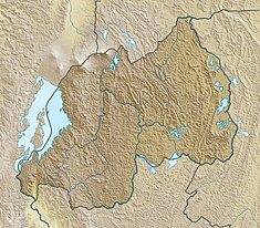 Map of Rwanda showing the location of Akanyaru Multipurpose Dam | |
| Country | Rwanda |
| Location | Akanyaru River, Gisagara District, Southern Province |
| Coordinates | 02°37′25″S 29°55′51″E / 2.62361°S 29.93083°E |
| Purpose | Drinking, Irrigation & Power |
| Status | Proposed |
| Construction began | 2022 Expected |
| Opening date | 2025 Estimate |
| Construction cost | US $190 million |
| Dam and spillways | |
| Impounds | Akanyaru River |
| Height | 50 metres (164 ft) |
| Dam volume | 333,000,000 cubic metres (1.1759784018×10¹⁰ cu ft) |
| Reservoir | |
| Normal elevation | 1,400 m (4,600 ft) |
| Commission date | 2025 (expected) |
| Turbines | 2 |
| Installed capacity | 14.5 MW (19,400 hp) |
The Akanyaru Multipurpose Dam, is a planned dam across the Akanyaru River, at the international border between Rwanda and Burundi. The dam will create a reservoir with storage capacity of 333,000,000 cubic metres (1.1759784018×10¹⁰ cu ft). The water is expected to supply drinking water to an estimated 614,200 people in both countries. The reservoir is also expected to provide irrigation water to an estimated 12,474 hectares (30,820 acres) of agricultural land in Burundi and Rwanda, benefitting an estimated 24,948 farmers. The dam will also host Akanyaru Hydroelectric Power Station, with generating capacity of 14.5 MW (19,400 hp).[1]
- ^ Jean Marie Takouleu (25 February 2021). "Rwanda/Burundi: the two countries will mobilize $190 million for the Akanyaru dam". Paris, France: Afrik21.africa. Retrieved 26 February 2021.