Administrative geography of the United Kingdom information
Geographical subdivisions of local government in Great Britain and Northern Ireland
Administrative units of the United Kingdom and its dependent territoriesAdministrative units of the United Kingdom
The administrative geography of the United Kingdom is complex, multi-layered and non-uniform. The United Kingdom, a sovereign state to the northwest of continental Europe, consists of England, Northern Ireland, Scotland and Wales. For local government in the United Kingdom, England, Northern Ireland, Scotland and Wales each have their own system of administrative and geographic demarcation. Consequently, there is "no common stratum of administrative unit encompassing the United Kingdom".[1]
Because there is no written document that comprehensively encompasses the British constitution, and owing to a convoluted history of the formation of the United Kingdom, a variety of terms are used to refer to its constituent parts, which are sometimes called the four countries of the United Kingdom.[2] The four are sometimes collectively referred to as the Home Nations, particularly in sporting contexts. Although the four countries are important for legal and governmental purposes, they are not comparable to administrative subdivisions of most other countries.
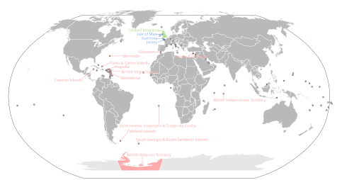
The United Kingdom also contains 17 dependent territories which aren't officially a part of the UK but are represented by it in places like the UN.
Historically, the subnational divisions of the UK have been the county[3] and the ecclesiastical parish, whilst following the emergence of a unified parliament of the United Kingdom, the ward and constituency have been pan-UK political subdivisions. More contemporary divisions include Lieutenancy areas and the statistical territories defined with the modern ITL (formerly NUTS) and ISO 3166-2:GB systems.
^United Nations Economic and Social Council (August 2007). "Ninth United Nations Conference on the standardization of Geographical Names" (PDF). unstats.un.org. Archived from the original (PDF) on 30 October 2008. Retrieved 21 October 2008.
^Scottish Parliament. "Your Scotland questions; Is Scotland a country?". scottish.parliament.uk. Archived from the original on 21 June 2008. Retrieved 1 August 2008. As the UK has no written constitution in the usual sense, constitutional terminology is fraught with difficulties of interpretation and it is common usage nowadays to describe the four constituent parts of the UK (Scotland, England, Wales and Northern Ireland) as "countries".
^Bryne, T., Local Government in Britain, (1994)
and 28 Related for: Administrative geography of the United Kingdom information
54.000; -2.500 TheUnitedKingdom is a sovereign state located off the north-western coast of continental Europe. With a total area of approximately 244...
Kingdom has its own separate system. For an overview, see AdministrativegeographyoftheUnitedKingdom. For details, see: Local government in England Local...
The economic geographyoftheUnitedKingdom reflects its high position in the current economic league tables, as well as reflecting its long history as...
reverted to the thana system in 1992. Later in 1999 geographic regions under administrations of thanas were converted into upazilas. All administrative terms...
geography), human impact characteristics (human geography), and the interaction of humanity and the environment (environmental geography). Geographic...
Governance (Scotland) Act 2004 AdministrativegeographyoftheUnitedKingdom Political make-up of local councils in theUnitedKingdom Wikimedia Commons has media...
AdministrativegeographyoftheUnitedKingdom British–Irish Council British and Irish Lions British Overseas Territories Glossary of names for the British...
Since 1922, theUnitedKingdom has been made up of four countries: England, Scotland, Wales (which collectively make up Great Britain) and Northern Ireland...
statistical geographies. ONS Postcode Directory (ONSPD) for theUnitedKingdom - relates both current and terminated postcodes in theUnitedKingdom to a range...
grouped by its former greater administrative areas from 1949 to 1952. China portal Administrative divisions of China List of ecoregions in China Northern...
is a geocode standard for referencing the subdivisions oftheUnitedKingdom for statistical purposes, used by the Office for National Statistics (ONS)...
This is a list of cities in theUnitedKingdom that are officially designated such as of 12 November 2022[update]. It lists those places that have been...
The economy oftheUnitedKingdom is a highly developed social market economy. It is the sixth-largest national economy in the world measured by nominal...
part oftheUnitedKingdom itself, are part of its sovereign territory. The permanently inhabited territories are delegated varying degrees of internal...
expectancy AdministrativegeographyoftheUnitedKingdom Subdivisions of England Demographics oftheUnitedKingdom "Life expectancy for local areas ofthe UK:...
officially theKingdomof Eswatini and also known by its former official name Swaziland (/ˈswɑːzilænd/ SWAH-zee-land) and formerly theKingdomof Swaziland...
Sea "Standard Area Measurements (Latest) for Administrative Areas in theUnitedKingdom (V2)". Open Geography Portal. Office for National Statistics. 5 April...
TheUnitedKingdom has three distinctly different legal systems, each of which derives from a particular geographical area for a variety of historical...
Postal codes used in theUnitedKingdom, British Overseas Territories and Crown dependencies are known as postcodes (originally, postal codes). They are...
 Global Information