This article needs additional citations for verification. Please help improve this article by adding citations to reliable sources. Unsourced material may be challenged and removed. Find sources: "A135 road" – news · newspapers · books · scholar · JSTOR(December 2020) (Learn how and when to remove this message)
A135
Route information
Length
3.7 mi (6.0 km)
Major junctions
North end
Stockton-on-Tees
South end
Yarm
Location
Country
United Kingdom
Road network
Roads in the United Kingdom
Motorways
A and B road zones
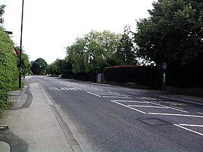
The A135[1] is a road in England, running from Stockton-on-Tees through Eaglescliffe to Yarm on the A67, on the boundary with the River Tees. It is also known as Yarm Road, and was the A19 before the dual carriageway was built.
In the 19th century, a stagecoach raced along Yarm Road against Locomotion Number One which ran alongside on the Stockton to Darlington railway line. There is no record as to which won the race.
Traffic statistics by year: All traffic[2]
2000
2001
2002
2003
2004
2005
Pedal Cycles
158
151
157
141
114
96
Motorcycles and Mopeds
150
156
158
177
156
158
Cars
18,666
19,039
19,001
18,735
18,773
18,304
Buses and Coaches
437
445
455
406
378
372
Light Goods Vehicles
2,047
2,039
2,043
2,227
2,207
2,264
Two-axle Rigid HGVs
214
210
202
217
218
209
Three-axle Rigid HGVs
15
17
17
19
20
19
Four-axle Rigid HGVs
3
3
3
3
4
4
Three-axle Articulated HGVs
45
40
36
34
33
29
Five-axle Articulated HGVs
52
45
39
35
30
26
Six-axle Articulated HGVs
13
15
17
19
20
22
All HGVs
342
330
314
327
325
309
All motor vehicles
21,642
22,009
21,971
21,872
21,839
21,407
Traffic statistics by year: Eastbound[2]
2000
2001
2002
2003
2004
2005
Pedal Cycles
88
84
87
78
63
53
Motorcycles and Mopeds
77
80
81
91
80
81
Cars
8,919
9,097
9,079
8,952
8,970
8,746
Buses and Coaches
211
215
220
196
183
180
Light Goods Vehicles
971
967
969
1,056
1,047
1,074
Two-axle Rigid HGVs
105
103
99
106
107
102
Three-axle Rigid HGVs
9
10
10
11
12
11
Four-axle Rigid HGVs
1
1
1
1
1
1
Three-axle Articulated HGVs
19
17
15
14
14
12
Five-axle Articulated HGVs
24
21
18
16
14
12
Six-axle Articulated HGVs
4
5
6
7
7
8
All HGVs
168
157
149
155
155
146
All motor vehicles
10,340
10,516
10,498
10,450
10,435
10,227
Traffic statistics by year: Westbound[2]
2000
2001
2002
2003
2004
2005
Pedal Cycles
70
67
70
63
51
43
Motorcycles and Mopeds
73
76
77
86
76
77
Cars
9,747
9,942
9,922
9,783
9,803
9,558
Buses and Coaches
226
230
235
210
195
192
Light Goods Vehicles
1,076
1,072
1,074
1,171
1,160
1,190
Two-axle Rigid HGVs
109
107
103
111
111
107
Three-axle Rigid HGVs
6
7
7
8
8
8
Four-axle Rigid HGVs
2
2
2
2
3
3
Three-axle Articulated HGVs
26
23
21
20
19
17
Five-axle Articulated HGVs
28
24
21
19
16
14
Six-axle Articulated HGVs
9
10
11
12
13
14
All HGVs
180
173
165
172
170
163
All motor vehicles
11,302
11,493
11,473
11,422
11,404
11,180
^"Google Map of A135 route". Retrieved 20 September 2007.
^ abc"Traffic statistics on the A135, Stockton-on-Tees, Stockton-on-Tees | NZ440186". roadtrafficstats.uk. Retrieved 14 November 2023.
The A135 is a road in England, running from Stockton-on-Tees through Eaglescliffe to Yarm on the A67, on the boundary with the River Tees. It is also known...
the city A135road (England), a road in Teesside connecting Stockton-on-Tees and Yarm Austin A135, a 1947 British luxury car RFA Argus (A135), a 1984...
became part of the British Motor Corporation (BMC). Austin A135 Princess II (DS3) Austin A135 Princess II (DS3) interior The Austin Princess IV was introduced...
called Grove Road and for much of the distance after crossing Roman Road it forms the eastern boundary of Mile End Park. Where the road passes under the...
List of A roads in zone 1 in Great Britain beginning north of the River Thames, east of the A1 (roads beginning with 1). "Old Stoke Bridge, Ipswich"....
A roads in zone 6 in Great Britain starting east of the A6 and A7 roads, and west of the A1 (road beginning with 6). "A613 (Gateshead)". sabre-roads.org...
now being the A67 then the A135 through Stockton. About 2 miles (3.2 km) from the Parkway Turn (A174) in Middlesbrough the road is raised slightly, overlooking...
The A1156 road runs through the centre of Ipswich, Suffolk, England. Formerly part of the A45, the road connects the A14, to the north-west of Ipswich...
The A1086 is a road in County Durham, north-east England. The route of the A1086 starts from the A19 junction in Easington and runs to the A179 junction...
B roads are numbered routes in Great Britain of lesser importance than A roads. See the article Great Britain road numbering scheme for the rationale behind...
A1078 is an English A road entirely in the county of Norfolk. It runs from a junction with the A148 King's Lynn to Cromer Road in the town of King's Lynn...
The A118 is a road in east London, England which links Bow Interchange with Gallows Corner in Romford via Stratford and Ilford. The section from Bow Interchange...
also known as the Southend Arterial Road, is a major road in Essex, England. It was constructed as a new arterial road project in the 1920s, linking Romford...
with the A135 in Eaglescliffe. From there it heads south through Yarm and Kirklevington before joining the A19 road at Crathorne. The road has been described...
The A140 is an 'A-class' road in Norfolk and Suffolk, East Anglia, England partly following the route of the Roman Pye Road. It runs from the A14 near...
is a major road in North Yorkshire, England. It runs from Stokesley to Skelton. "A173 - Roader's Digest: The SABRE Wiki". www.sabre-roads.org.uk. Retrieved...
The A142 is a road that runs from Newmarket in Suffolk to Chatteris in Cambridgeshire. Davidge, William Robert (1934). cambridgeshire regional planning...
and Wear. The road runs from Simonside to Marsden via Harton Nook. It is 3.7 miles (6 km) long. The A1300 begins as the John Reid Road at the junction...
The A167 and A167(M) is a road in North East England. It is partially a trunk road and partially a motorway, where it is commonly referred to as Newcastle...
A1067 is an English A road entirely in the county of Norfolk. It runs from Fakenham Northern By-Pass (A148) to Norwich inner ring road (A147). Norfolk County...
The A146 is an A road that connects Norwich in Norfolk and Lowestoft in Suffolk, two of East Anglia's largest population centres. It is around 27 miles...
The Rotherhithe Tunnel, designated the A101, is a road tunnel under the River Thames in East London, connecting Limehouse in the London Borough of Tower...
A road in Lowestoft, Suffolk, England. It links the A1117 to central Lowestoft and the A12. KML file (edit • help) Template:Attached KML/A1144 road KML...
The A151 road is relatively minor part of the British road system. It lies entirely in the county of Lincolnshire, England. Its western end lies at coordinates...
road connects Sunderland and Washington in Tyne and Wear, North East England. It is the main road connecting these towns and is one of the main roads...
 Global Information